BOZEMAN – A new and powerful Pacific cold front will pass through the region Thursday into Friday.
This storm system will produce another round of possibly damaging wind gusts, light to moderate snow, and turning much colder behind the front on Friday.
The combination of sustained surface wind 30 to 45 mph with peak gusts 60 to 75 mph, falling snow, and snow on the ground could bring significant areas of blowing snow with dangerous travel conditions with low visibility.
The strongest wind gusts should be Thursday afternoon along the frontal system but out ahead of the storm and for a short time behind the frontal passage wind gusts will be very strong at times.
The National Weather Service issued a HIGH WIND WARNING across most of SW Montana Thursday morning through Friday morning. Sustained surface winds 35 to 45 mph are likely and peak gusts 60 to 75 mph are possible.

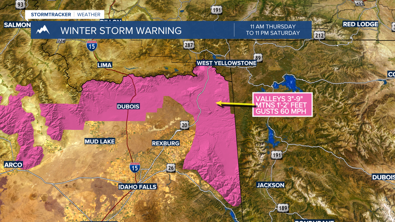
The National Weather Service has issued WINTER STORM WARNINGS along the MT/ID state line on the Idaho side of Monida Pass over to Island Park, ID from 11 am Thursday to 11 pm Saturday.
Valleys could see 3”-9” of snow with most mountain ranges picking up 1 to 2 feet of snow along with wind gusts up to 60 mph.