


BOZEMAN – Active weather pattern Friday afternoon and evening as a cold front slowly passes through the region.
Look for increasing showers, thunderstorms, and locally heavy rainfall. Some thunderstorms could be strong to severe producing damaging wind gusts and/or hail.
The Storm Prediction Center continues a “Marginal” risk for severe thunderstorms over Madison, Gallatin, Park counties Friday afternoon through Friday evening.

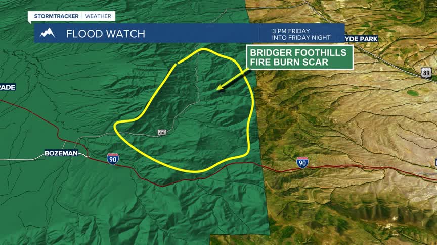
The National Weather Service has issued a FLOOD WATCH for Gallatin county ONLY for the Bridger Foothills Fire burn scar from 3 pm Friday through Friday evening.

Flash flooding and debris flows are possible if locally heavy rain occurs over the burn scar. As we reported several weeks ago, this area is a big concern for debris flows and flash flooding as the burned area has a sublayer called the hydrophobic layer that repels water. In steep terrain there is a high risk for runoff and flash flooding that can carry debris rapidly downhill.
Latest forecast model shows the Bozeman area could see over an inch or moisture Friday afternoon through Sunday afternoon.

Higher elevations could also see some heavy wet snow Friday night into Saturday morning. This will create raw backcountry conditions and it could also lead to a higher avalanche danger on steep terrain.

Temperatures will be well below normal this weekend and cold enough that snow could stick to grassy areas in the lower valleys by Saturday morning.
