


BOZEMAN – Severe thunderstorms are likely to impact SW Montana Sunday afternoon through early evening.
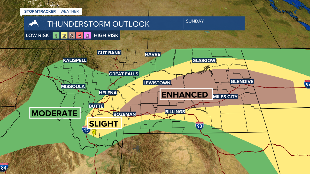
The National Weather Service issued a SEVERE THUNDERSTORM WATCH through 8 pm Sunday night for SW Montana east of the divide.

Damaging hail greater than 1” in diameter and/or damaging wind gusts up to or over 60 mph. Heavy rainfall and frequent lightning will also occur with these storms.
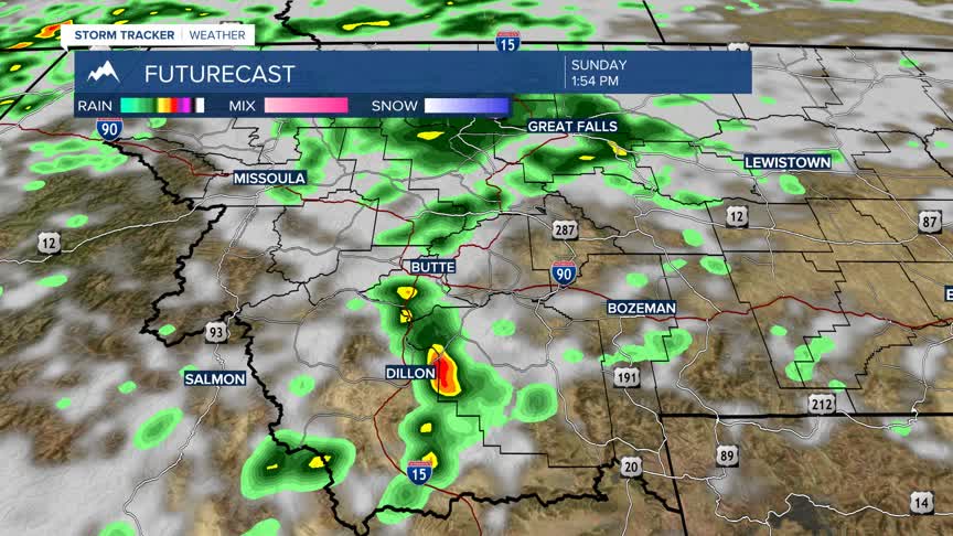
Severe thunderstorms started over Southern Beaverhead County around 1 pm and this is just the beginning of the storm event.
The Storm Prediction Center has a higher risk of damaging storms from Dillon to Bozeman eastward. Strong to severe thunderstorms are possible west of the divide but the higher probability will be east of the divide.
Forecast models show most storms should diminish around sunset, however, for the Butte fireworks show tonight gusty outflow winds from diminishing thunderstorms could impact the fireworks show tonight.
This pattern is likely again Monday into Tuesday.
The latest forecast model run shows mostly dry weather for the 4th of July parades around SW Montana Monday morning and scattered showers and thunderstorms developing by early to late afternoon. That could change but for now plan on cooler temperatures, gusty winds and a slight chance for showers Monday morning with increasing showers and thunderstorms by afternoon.
