


BOZEMAN – Finally some good moisture over SW Montana Monday and Tuesday. This storm system is spinning out of the region and we should be between storm systems for Wednesday.
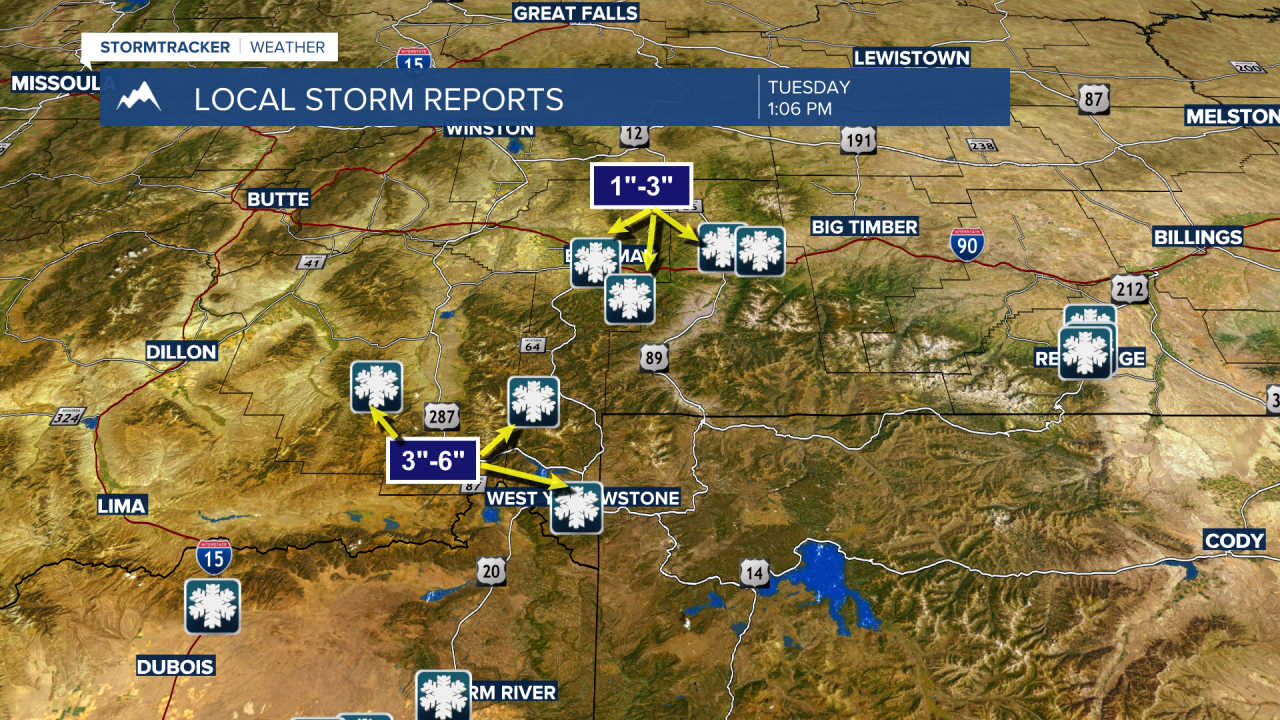
Bozeman to Ennis to West Yellowstone and over to Billings we have seen reports of 1”-3” of wet slushy snow around Bozeman but 3”-6” of snow from Big Sky to West Yellowstone over to Cameron.
Temperatures should be chilly Wednesday morning but warm above normal by Wednesday afternoon.
The next disturbance to impact the region will be a cold front early Thursday morning. Cooler temperatures, gusty winds, and scattered valley rain or snow with a better chance of snow most mountain ranges Thursday into Friday morning.
Another disturbance will impact the region Saturday afternoon and with it a slight chance for showers but another shot of cooler air by Sunday.
This is a good pattern to see with a chance for rain or snow every other day or so and most mountain ranges should continue to see much needed Spring wet snowfall.
Temperatures over the next 5 to 7 days will vary greatly across Montana. Ahead of each disturbance we could warm above normal but as each cold front passes through a sharp drop in temperature is likely so keep checking in with me for updated weather forecasts.
