BOZEMAN – A mostly dry cold front is sweeping over northern Montana today and should continue to produce gusty winds over the state through tonight.
Temperatures should be only slightly cooler over the next couple of days but remain near to slightly above normal.
The combination of hot, dry, and windy conditions will keep critical fire weather alive through at least Thursday evening. There is a RED FLAG WARNING up for most of Montana roughly north of I-90 through Thursday evening. This means human caused fires are likely and we all need to use extreme caution with all outdoor activities to avoid accidental new fire starts. Small fires can grow out of control very quickly especially in the late afternoon through early evening hours.

Monsoonal moisture will try and kick off a few very isolated thunderstorms over Southern Beaverhead, Madison, Gallatin, Park counties and inside Yellowstone National Park Tuesday afternoon. This pattern is likely again Wednesday afternoon with a better chance of isolated thunderstorms over most of SW Montana Thursday and Friday afternoon.
Thunderstorm activity will bring concern for possible new lightning caused fire starts by the end of the week.
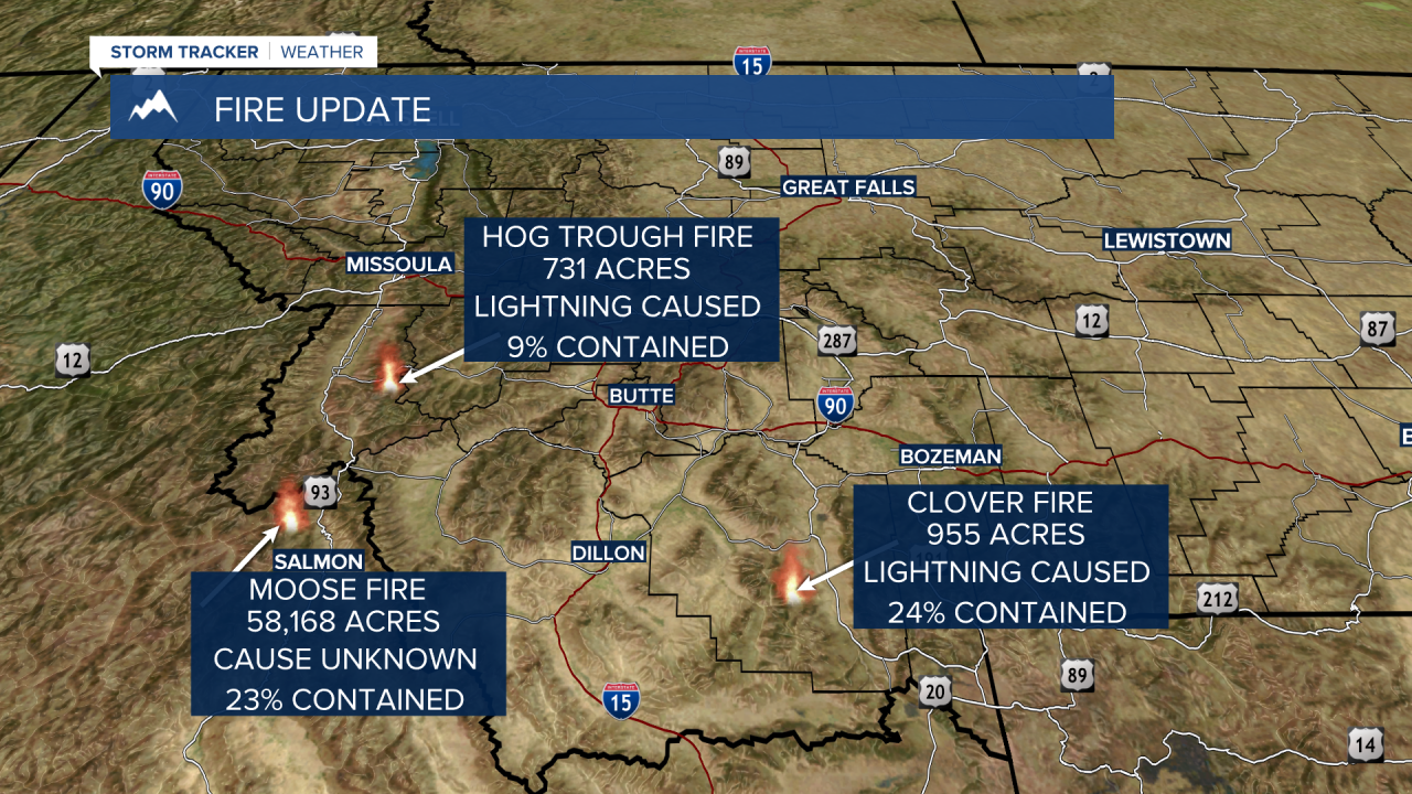
Fire update: The Moose Fire north of Salmon, ID had the most growth over the last 24 hours and is the main smoke producer over SW Montana. The Hog Trough Fire and the Clover Fire saw minimal growth over the last 24 hours but will continue to produce smoke over the region. The Elmo Fire near Flathead Lake could produce smoke at times over SW Montana if the flow aloft is out of the NW. Dillon to Ennis to Big Sky will see thick smoke at times for the rest of the week and there will be some moderate smoke over Butte and Bozeman this week as well, if you have health problems limit your outdoor exposure as much as possible.