


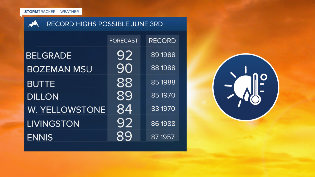
BOZEMAN – Near record highs are likely Wednesday afternoon but numerous record highs are very likely by Thursday afternoon.
A blocking High-pressure ridge is sitting over most of the western US today and a much stronger SW flow is expected by Thursday forcing temperatures to shoot well above normal.
Our first round of 90° heat is possible for many reporting stations in SW Montana Thursday afternoon.
This heatwave will continue into Friday but a weak disturbance will arrive by Friday early evening, producing scattered thunderstorms.
Storm Prediction Center’s day 3 convective outlook has a “marginal” risk for strong to severe thunderstorms over SW Montana mostly east of I-15.

This means a few thunderstorms could be strong enough to produce property damage. Large hail or damaging wind gusts are possible. Some storms could also produce brief heavy rainfall.
Temperatures by the weekend will begin to cool slowly and could be back down to near normal levels by early next week.
