


BOZEMAN – No surprises in the general weather pattern today. As expected the weather is active with areas of rain, snow and wind.
A pair of storms will impact the regional weather pattern for several more days. The first system is here producing cool and wet conditions. The second storm will arrive Tuesday night and Wednesday producing very strong surface wind gusts.
Snow levels are high today with accumulating snow likely above 7,000’. There could be some moderate to heavy snow above 7,000’ through this evening into Tuesday morning especially for Madison and Gallatin counties. Big Sky to West Yellowstone look for snow tonight and Ennis over Norris Hill could see some and wintry travel impacts by early Tuesday morning.
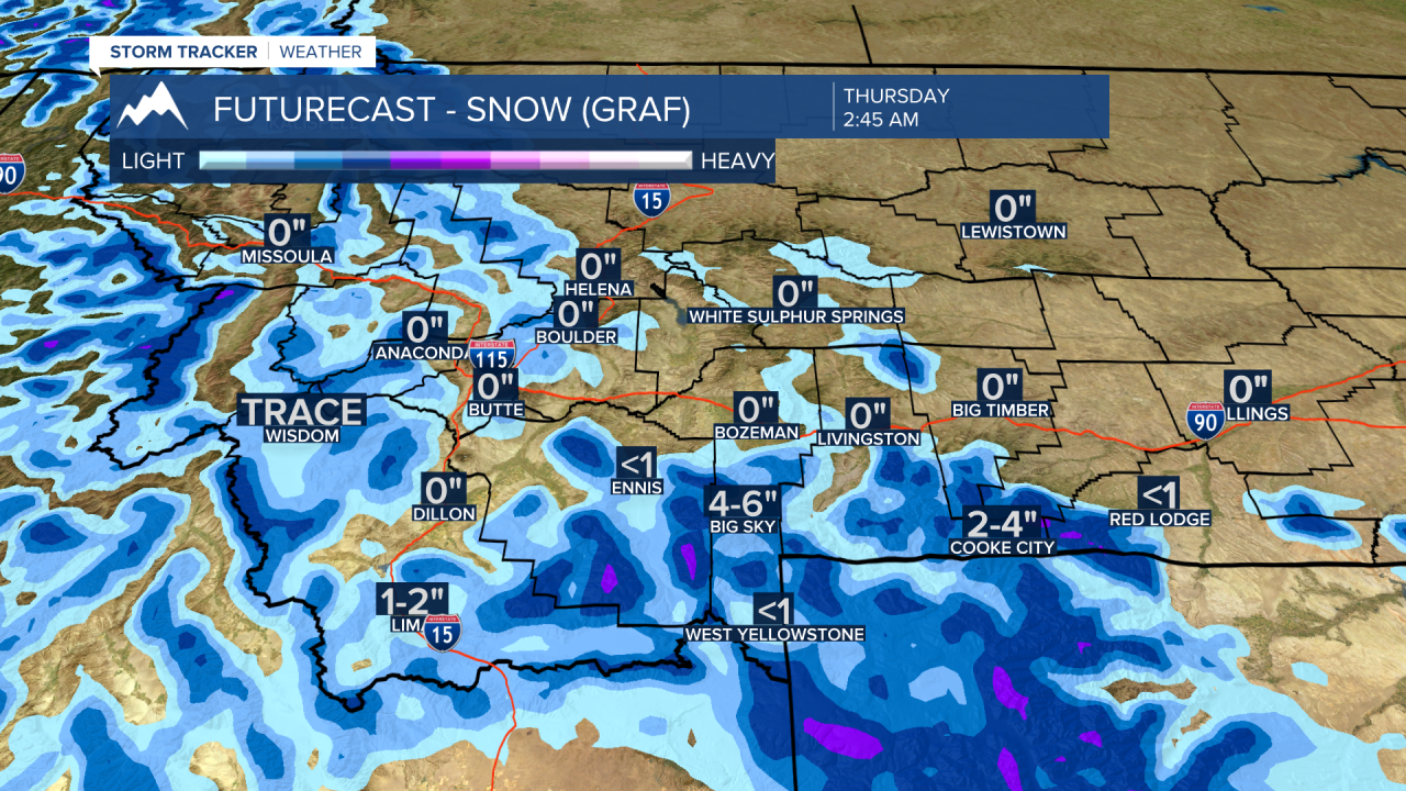
There is a slight chance for early morning snow for Bozeman and Bozeman pass as well but temperatures should be warm enough to melt anything that sticks to ground by late morning. Slow-go travel should be planned for again in Madison and Gallatin Counties for Tuesday morning.
Next system arrives Tuesday evening into Wednesday morning and could produce scattered snow showers over most mountain passes. This storm has an incredible deep area of Low-pressure associated with it and that means strong wind gusts are coming beginning early Wednesday morning through Wednesday evening.
Right now, the National Weather Service has a HIGH WIND WATCH up along the Rocky Mountain Front eastward through the central plains of Montana. (see graphic)
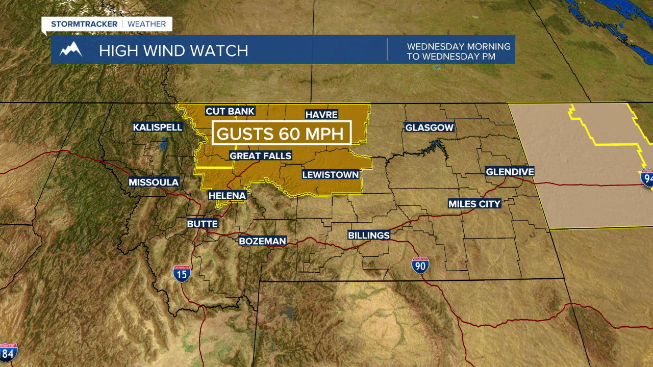
Peak wind gusts in these areas highlighted in dark brown could see gusts up to or over 60 mph Wednesday afternoon.
At the time of this update there are no wind highlights up for SW Montana, however, that could change. Forecast models are predicting peak wind gusts between 30 to 50 mph for most locations in SW Montana Wednesday. High wind prone areas could see gusts over 50 mph. I am anticipating additional high wind statements from the National Weather Service to be issued for Wednesday later Monday or possibly by Tuesday morning so please stay tuned to the KBZK STORMTracker weather app.

