


BOZEMAN – The next weathermaker is a warm core Pacific storm with a warm front and cold front combo to produce a wide variety of precipitation types over Montana.
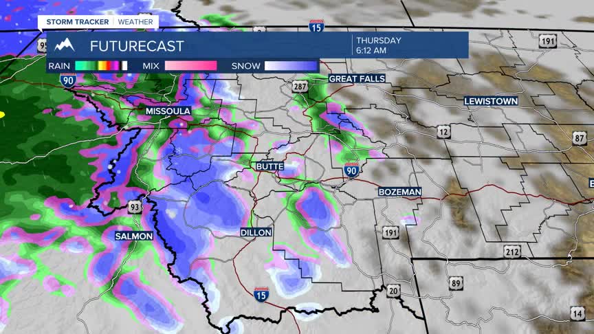
The storm will move into western Montana tonight with the warm first, producing areas of valley rain and higher mountain snow. There is a chance for pockets of freezing rain in the lower valleys especially in valley inversion regions of west central and northwestern Montana.
The National Weather Service did issue a WINTER WEATHER ADVISORY for hazardous travel conditions from Missoula to Kalispell from 4 am to noon Thursday. This region has the best chance of freezing rain producing very icy road conditions.

SW Montana could see some pockets of freezing rain between Butte and Missoula and a slight chance for some freezing east of the divide including Bozeman.
Higher elevation snow is likely Thursday into Friday morning. Above 6,000’ will have the best chance of accumulating snow with moderate snow possible from Big Sky to West Yellowstone to Cooke City.

This storm system will be gone by Friday evening, but another similar storm system will begin to move into western Montana Sunday afternoon impacting travel conditions again by early next week.
