


BOZEMAN – The weather forecast is looking good for widespread moisture to impact most of western, SW, and central Montana through Friday and possibly into the weekend.
Along the Rocky Mountain Front and Continental Divide will see the higher amounts of snow and for those mountain peaks above 8,000’ there could be over a foot of heavy wet snow. Most mountain passes will see some snow locally in SW Montana. MacDonald Pass, Homestake Pass, Boulder Hill, Elk Park, and Georgetown Lake areas could see 2”-10” of snow.


Bozeman Pass to Big Sky could see some minor slushy accumulations in the early morning hours Thursday and Friday.
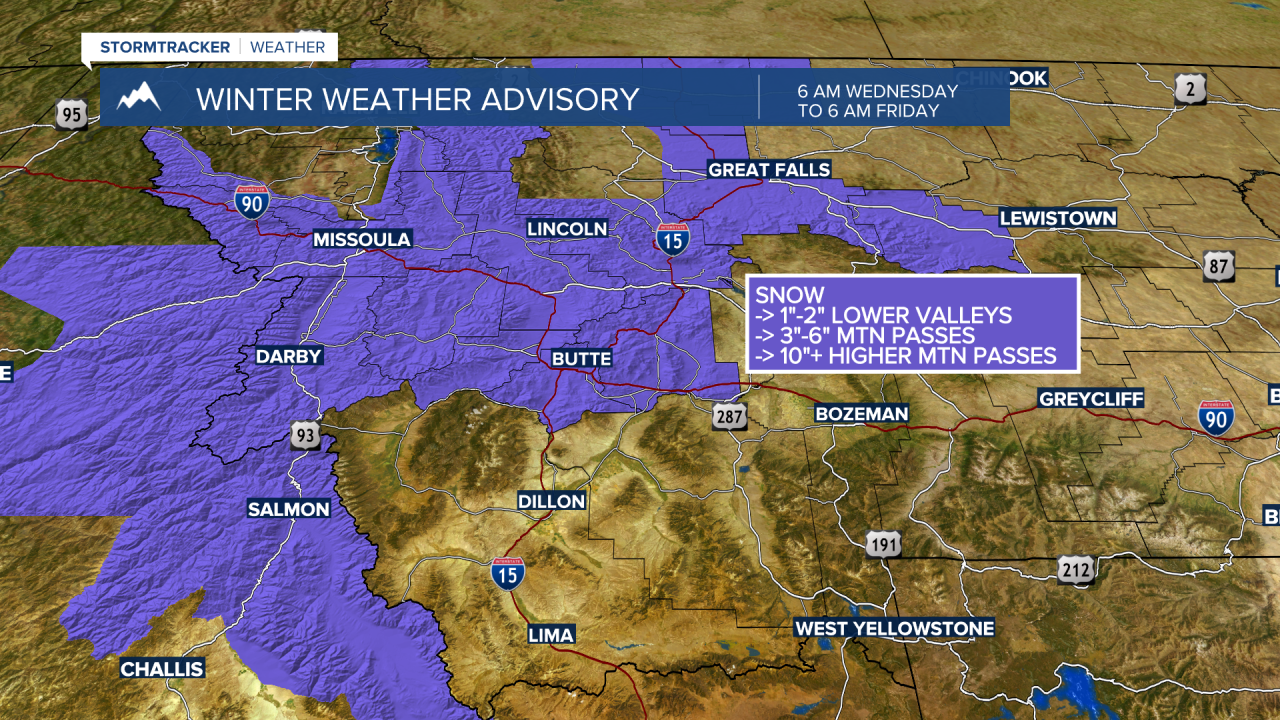
Winter Weather Advisory is up through Friday morning. Counties impacted are: Silver Bow, Jefferson, Deer Lodge, Granite, Powell, and Lewis and Clark.
Lower valleys could see several inches of snow Thursday morning and Friday. Most mountain passes could see 2”-6” of snow but MacDonald Pass could see up to 10” of snow through Friday morning.

Winter Storm WARNING continues along the Rocky Mountain Front through Friday morning.
Lower valleys could see 4”-8” of snow and higher elevations over a foot of snow is possible.
If you are traveling be prepared for wet roadways with snow or slush over mountain passes and higher mountain passes could become icy in the early morning hours. Locally windy conditions are also possible through Friday afternoon. In other words, slow-go travel conditions for a few days.
