


BOZEMAN - Severe winter weather to playout over the Pacific NW and Montana through the end of the week. Pay close attention to the latest forecast as travel conditions will be impacted greatly with heavy snow, blowing snow, and bitter wind chills.
1pm 24 hour change in air temperatures and wind chills in Montana:


This is a complex atmosphere with great potential for snow through Saturday morning. Anytime we see a clashing of airmasses the weather pattern will become very active. Arctic air is digging into Montana Tuesday afternoon with below zero temperatures and extremely cold wind chills for most of northern and central Montana.
The first of two storms will over-run the Arctic air producing increasing snow Tuesday evening into Wednesday afternoon. The snow will likely be a fine powder and easily blown around by wind and passing vehicles.
Storm number 2 is a much larger storm with considerable warm moist air. This will push the Arctic air out beginning Thursday afternoon but moderate to heavy snow is coming Thursday morning through Friday morning for SW Montana and this will impact travel conditions, especially Thursday.
Very heavy snow is possible from Wednesday night through Saturday morning west of the divide with valleys possibly picking 6”-12” and mountains 1 to 3 feet.
By the weekend the weather pattern will begin to settle down.
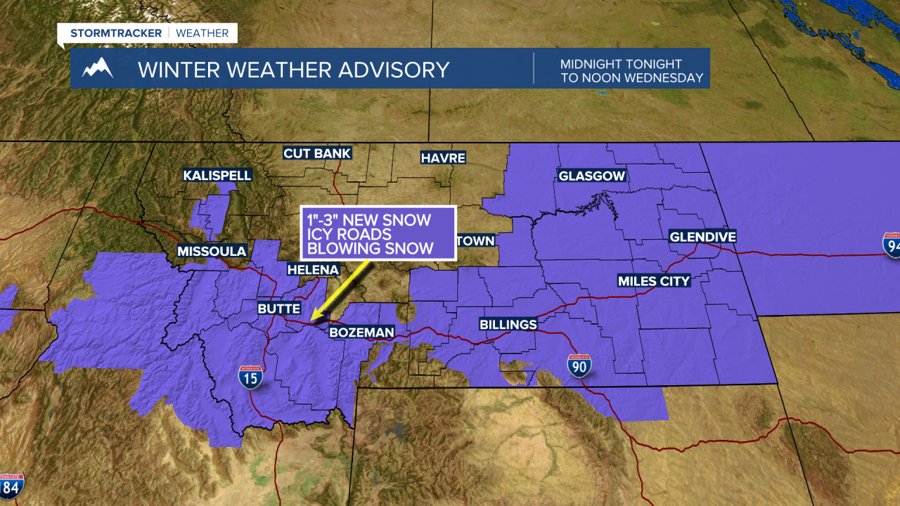
National Weather Service highlights are as follows:
The National Weather Service issued a WINTER WEATHER ADVISORY for SW Montana west and east of the divide from midnight tonight through noon Wednesday. Snow accumulations around 1”-3” with pockets of moderate snow possible for mountain passes. Locally windy conditions will produce some blowing snow and well below zero wind chills.
The National Weather Service issued a WINTER STORM WATCH (likely to be upgraded soon to a winter storm warning) from Wednesday evening through Saturday morning for western Montana through northern Idaho and most of Washington State.

Snow accumulations will be significant with valleys possibly seeing 6”-12” and mountains 1’ to 3’ feet of snow. Blowing snow and low visibility is also possible and wind chills around –15 below zero. There is also a chance for some freezing rain by Friday for lower valleys.
Snow for SW Montana will come in 2 waves. The first snow is tonight into Wednesday morning with 1”-3” possible and some areas could see a little more. This snow will mix with Arctic air. Plan on below zero to well below zero wind chills by Wednesday morning and some localized blowing snow.
A higher probability for moderate to heavy snow is coming with the second storm system Thursday into Friday morning. This system could produce 2”-6” of valley snow with some areas possibly above 6” and mountains could see a foot or more with highest mountain peaks possibly seeing several feet of snow. This will likely increase avalanche danger by the end of the weekend and this weekend.

