


BOZEMAN – A nasty Pacific storm will have a major impact on travel conditions across Montana Thursday night through Saturday with areas of snow and blowing snow.
The next weather maker is hitting the Pacific NW coast Thursday afternoon and will begin to move inland tonight and reaching SW Montana Friday afternoon. A strong cold front will pass through the region Friday afternoon producing strong surface wind gusts and snow.
Travel is not recommended at this time Friday as the combination of snow and powerful wind gusts will produce considerable areas of blowing and drifting snow along with extremely low visibility.
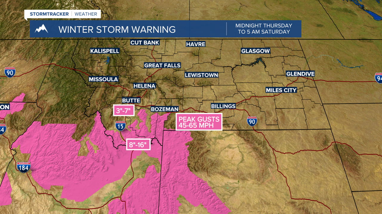
The National Weather Service has issued a WINTER STORM WARNING for the mountain ranges in Beaverhead, Madison, and Gallatin counties from Midnight Thursday to 5 am Saturday. Warnings are also up for Yellowstone National Park and across central and eastern Idaho including Island Park, ID and Monida Pass on both sides of the state line.
Snow accumulations of 8”-16” is possible especially along the MT/ID state line from Monida Pass over to West Yellowstone and up to Big Sky. Wind gusts 40 to 65 mph are also possible. This combination will produce whiteout travel hazards and possible road closures.
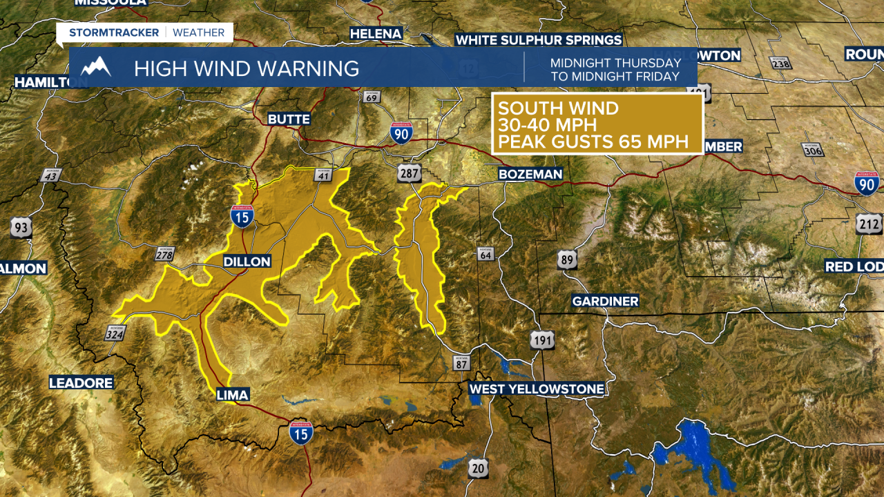
The National Weather Service has issued a HIGH WIND WARNING from midnight Thursday to Midnight Friday across Beaverhead and Madison counties.
Sustained wind 30 to 40 mph is likely and peak gusts to 65 mph are possible. Property damage is possible along with power outages in the warning area. Considerable areas of blowing ground snow along with falling snow will produce whiteout travel hazards and drifting snow.
The National Weather Service has issued a WINTER WEATHER ADVISORY west of the divide from noon Friday to 5 am Saturday.
The combination of 2”-5” of new snow and wind gusts to 40 mph will produce considerable areas of blowing snow and low visibility travel hazards.


This storm will quickly exit the region by Saturday morning and overall weather conditions will improve throughout the weekend.
