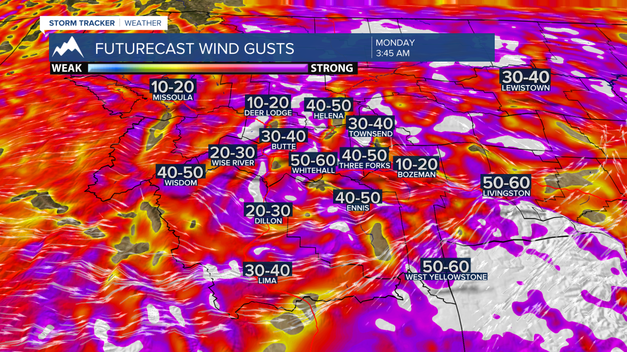
BOZEMAN – An intense cold front will pass through Montana tonight into Monday morning. This front will create incredibly strong surface wind gusts that could produce property damage and power outages. This front will also produce moderate snowfall and strong wind gusts in the early morning hours Monday which will impact travel with snow, blowing snow, reduced visibility, slushy roads turning to ice and a sharp drop in temperatures.
Ahead of the front temperatures have shot up into the 60s and 70s across the state and there is a chance for a few record highs in Montana Sunday afternoon.
The combination of warm, dry, and windy conditions has created a higher risk of wildland fires especially in low lying areas with dead vegetation.
The National Weather Service has issued a wide variety of warnings across Montana Sunday into Monday.
____________________________________________________________________________________________________________________________________________________________
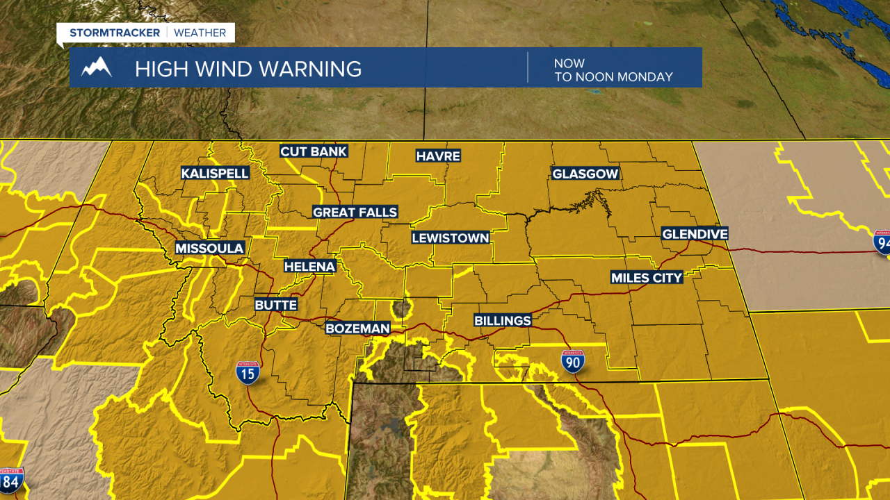
HIGH WIND WARNING
The National Weather Service continues a HIGH WIND WARNING for the entire state of Montana Sunday afternoon through Monday afternoon.
Peak wind gusts of 60+ mph is possible. That is strong enough to produce property damage, blow trees over into power lines with power outages, create considerable areas of blowing dust reducing visibility.
The strongest wind gusts will arrive overnight Sunday as a powerful cold front passes through Montana.
_________________________________________________________________________________________________________________________________________________________________________
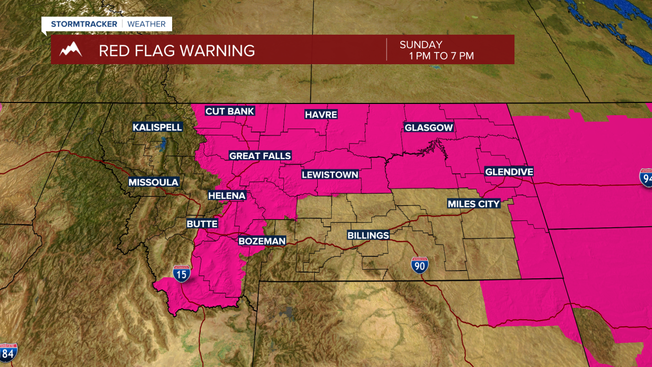
RED FLAG WARNING
The National Weather Service has issued a RED FLAG WARNING for SW Montana east of I-15 from 1 pm to 7 pm Sunday.
The combination of warm, dry, and windy conditions will create higher fire danger is low lying grassland areas. Use extreme caution with outdoor activities.
____________________________________________________________________________________________________________________________________________
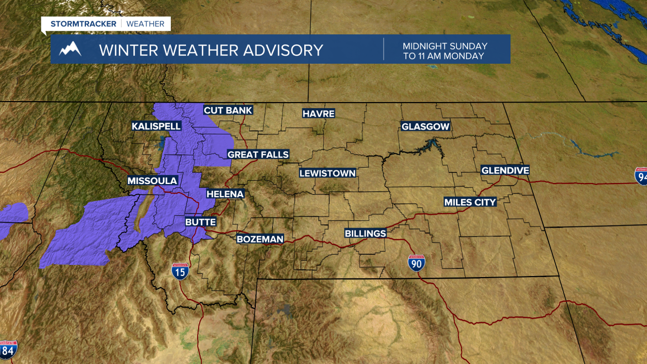
WINTER WEATHER ADVISORY
The National Weather Service has issued a WINTER WEATHER ADVISORY for the Butte/Blackfoot region from Midnight Sunday to 11 am Monday.
This includes: Homestake Pass, MacDonald Pass, Georgetown Lake, Butte.
Travel conditions will be affected by this storm with areas of blowing snow and reduced visibility. The cold front could produce localized heavy snowfall along with 60 mph wind gusts in the early morning hours Monday.