


BOZEMAN – A pattern change arrives Saturday evening for southern Montana as a cold front drops into northern Montana Saturday morning and digs slowly into the southern half of the state Saturday night.
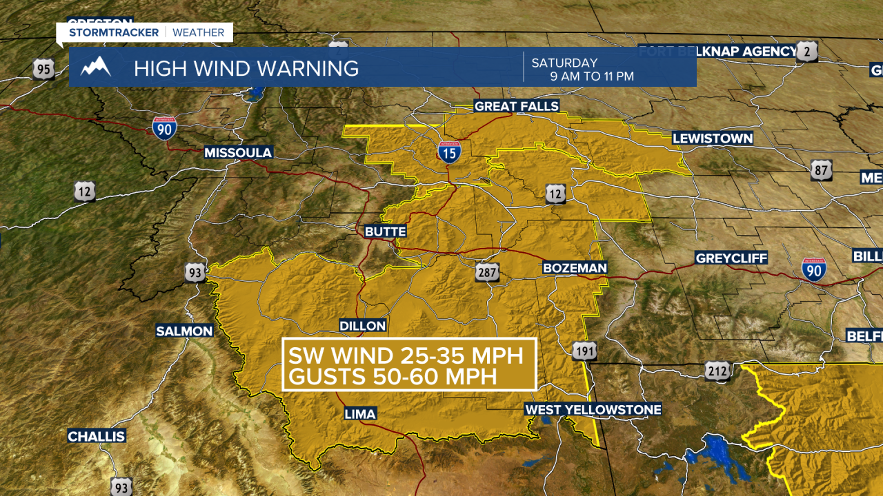
Ahead of this change strong surface wind gusts are likely to develop Saturday. The National Weather Service continues a HIGH WIND WARNING for SW Montana east of the divide Saturday 9 AM to 11 PM.
SW Montana could see peak wind gusts 50 to 60 mph with the strongest gusts in high wind prone areas like Norris Hill, Whitehall to Three Forks, and Livingston.
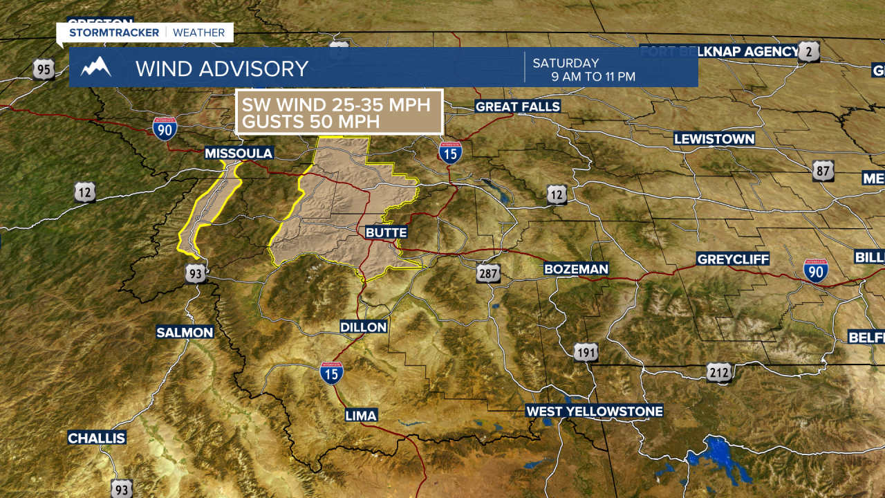
The National Weather Service issued a WIND ADVISORY for the Butte/Blackfoot region Saturday 9 AM to 11 PM. Sustained SW winds 20 to 30 mph and peak gusts to 50 mph are possible.
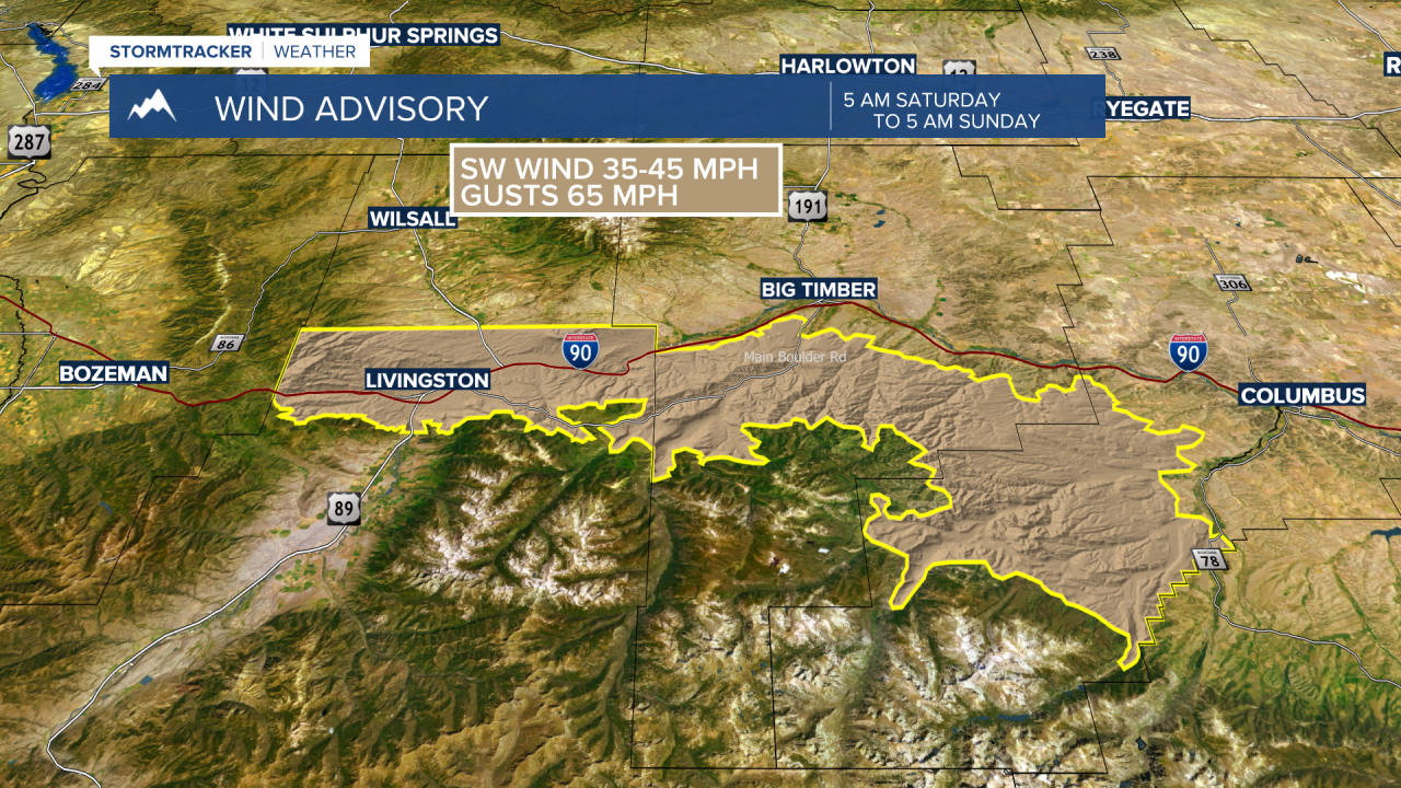
The National Weather Service issued a WIND ADVISORY for the Livingston region 5 am Saturday morning to 5 am Sunday morning. Strong crosswind gusts on I-90 in the Livingston area are likely and could be as strong as 65 mph. Cause if traveling in this region this weekend. Snow and wind is possible by Sunday morning.

Snow will develop as a cold front impacts northern Montana counties Saturday morning. There are a variety of Winter Weather Advisories and Winter Storm Warnings up across the hi-line Saturday. Areas of snow and blowing snow will impact travel for the northern half of the state Saturday.
That front will dig into SW Montana Saturday evening and could produce areas of snow and gusty winds in the early morning hours Sunday. Snow accumulations should be light for most valleys with around 1”-2” possible for Bozeman and Butte. Mountain passes locally in SW Montana could see 2”-4” of snow. The combination of snow, colder air, and strong wind gusts will produce slow-go travel or wintry travel conditions by Sunday morning.

Another shot of moisture will arrive Monday with areas of snow and possible travel impacts.
Montana State University playoff football weather Saturday is looking very windy for Bobcat Stadium. By 2 pm Saturday (kick-off) SW winds 20 to 30 mph are likely and peak gusts at times over 50 mph are possible for the entire game. Temperatures should be mild in the lower 50s, however, strong surface winds will create a chill so dress for cool and windy conditions.
