


BOZEMAN – A powerful Pacific storm blew through SW Montana Thursday evening and exited the state by Friday morning. Behind that storm Arctic air returned producing much colder temperatures that will linger throughout the weekend into next week.
Roads are snowpacked and icy and will likely remain that way through the weekend. Continue to allow extra travel time and practice good defensive driving techniques.
We are currently between storms with cold and dry conditions likely through Saturday.
The forecast for the Montana State Bobcats playoff home game is cold and dry. Morning lows Saturday will be slightly below zero and daytime highs could reach the low 20s. The forecast is sunny with a light SE wind and cold.

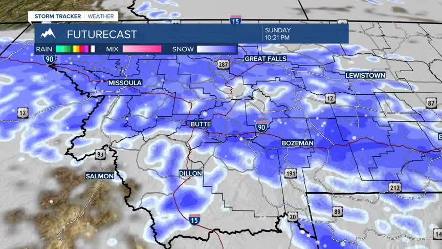
The next weather maker is now digging down the Pacific NW coast and will roll inland starting Saturday and reach SW Montana by Sunday afternoon. Another round of snow is coming and some forecast models are showing another moderate to heavy dumping of snow is possible. This will impact travel conditions Sunday afternoon through Tuesday morning. Plan accordingly for snow and blowing snow with difficult to hazardous travel conditions.
