


BOZEMAN – Same weather pattern but a different day. Conditions have not changed at all over the last 3 days. A SW flow aloft, limited mid-level moisture with a few isolated dry thunderstorms, extreme heat, and incredibly thick wildfire smoke.
Starting with air quality concerns, an AIR QUALITY ALERT is up through Tuesday morning for the northern half of SW Montana. Conditions will be re-evaluated Tuesday morning, but this alert is likely to remain in place for several days.

1 pm air quality conditions were rated “UNHEALTHY” in Butte and “UNHEALTHY FOR SENSITIVE GROUPS” in Bozeman.

Air quality does improve from Dillon to West Yellowstone but forecast models show wildfire smoke moving back into Dillon tonight and Tuesday.
Next topic is heat. The National Weather Service continues a “Heat Advisory” east of the divide for SW Montana through 9 pm Monday. Clouds and isolated thunderstorms should help keep temperatures slightly cooler compared to Sunday. Sunday’s max temperatures reached the upper 90s to lower 100s and for most reporting stations that is the hottest day of the year so far.

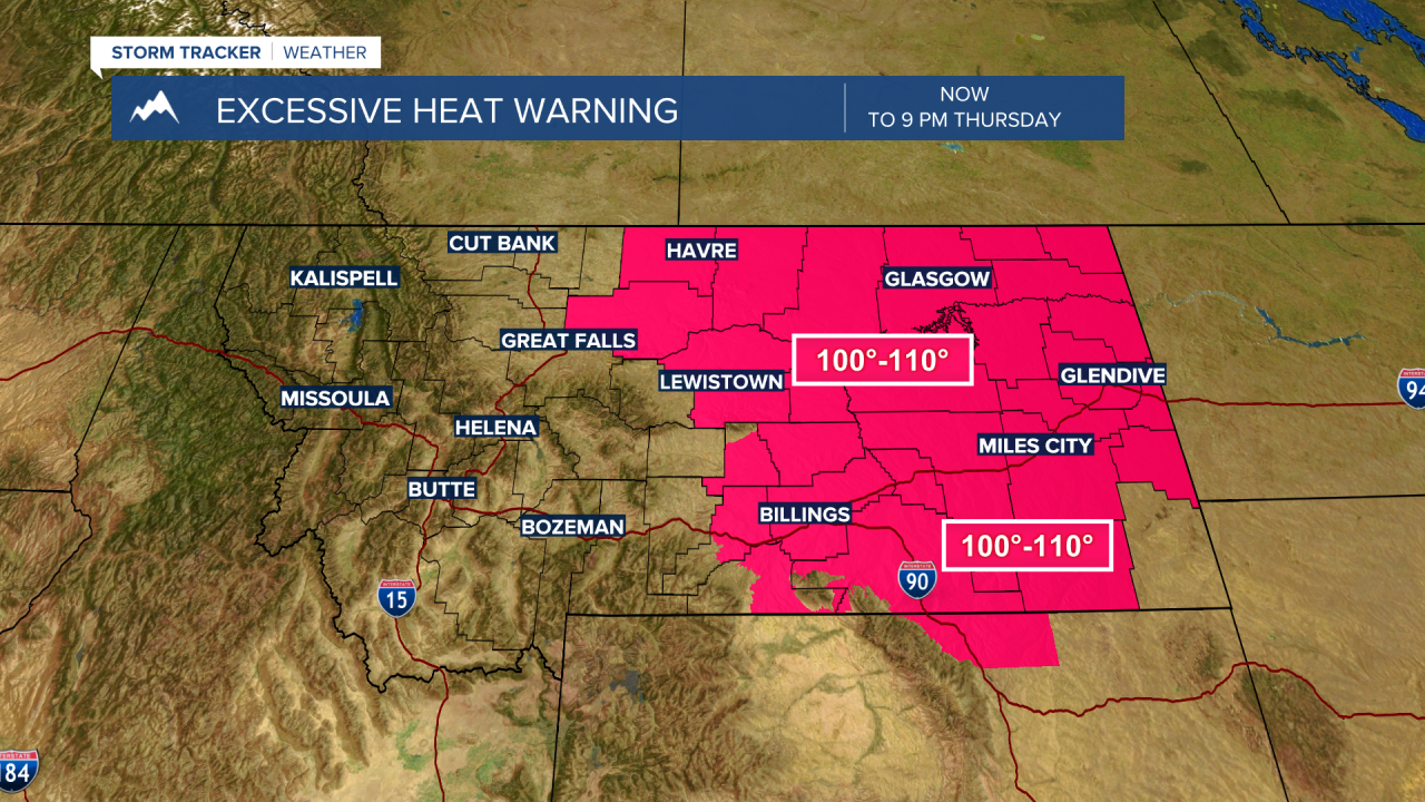
The National Weather Service has extended an EXCESSIVE HEAT WARNING for most of central and eastern Montana through Thursday. Forecast highs will remain in the 100-to-115-degree range. Reminder, the leading weather-related killer in the U.S. is extreme heat.
Fire weather concerns also remain in place for most of Montana for several days with the possibility of mostly dry thunderstorms and new fire starts. Lightning, erratic gusty wind, extremely dry fuels and well above normal temperatures will keep fire danger elevated. A RED FLAG WARNING is up locally through midnight tonight but look for additional warnings to be issued for Tuesday and Wednesday.

Monsoonal moisture in the mid-levels will produce scattered thunderstorms Monday afternoon, Tuesday afternoon and Wednesday afternoon. The lower levels are extremely dry and thus there is a higher probability of dry thunderstorms. Hopefully, we will see some wet storms as well but for now plan for the worst-case scenario.
Temperatures should cool slightly by the end of the week into the upcoming weekend but remain above normal.
