BOZEMAN – Finally temperatures are rising above zero today for most of SW Montana. Overall temperatures will remain cooler than normal as a new Pacific storm enters the picture.
Increasing and widespread snow will impact the entire state beginning Tuesday evening for west central and NW Montana and reaching SW Montana by Wednesday afternoon into Thursday morning.
The National Weather Service has issued a WINTER STORM WARNINGS and WINTER STORM WATCHES for a wide area of Idaho and Montana tonight through Thursday evening.
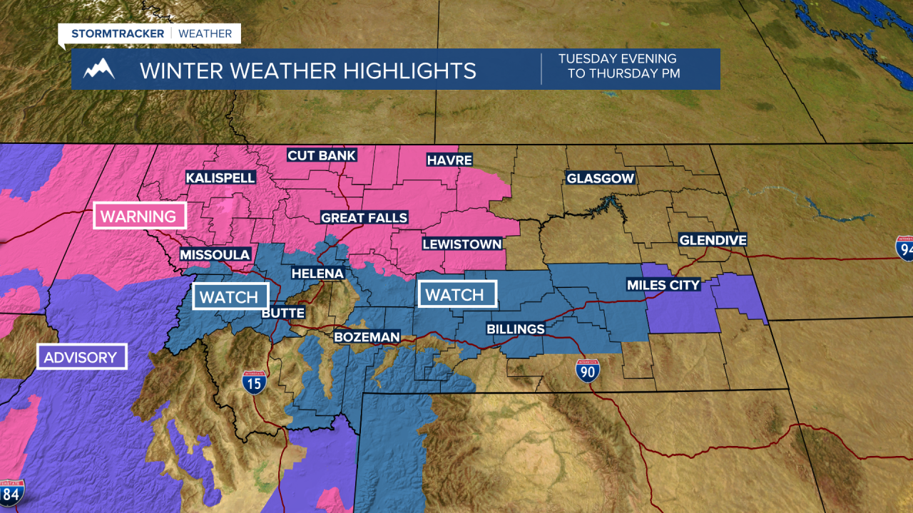
Snow could be heavy at times especially for mountain passes. There could be localized areas of blowing snow with this storm reducing visibility. Valleys and mountains will see periods of snow and thus difficult to hazardous travel conditions are likely to impact morning and evening commutes Wednesday and Thursday and possibly Friday morning.

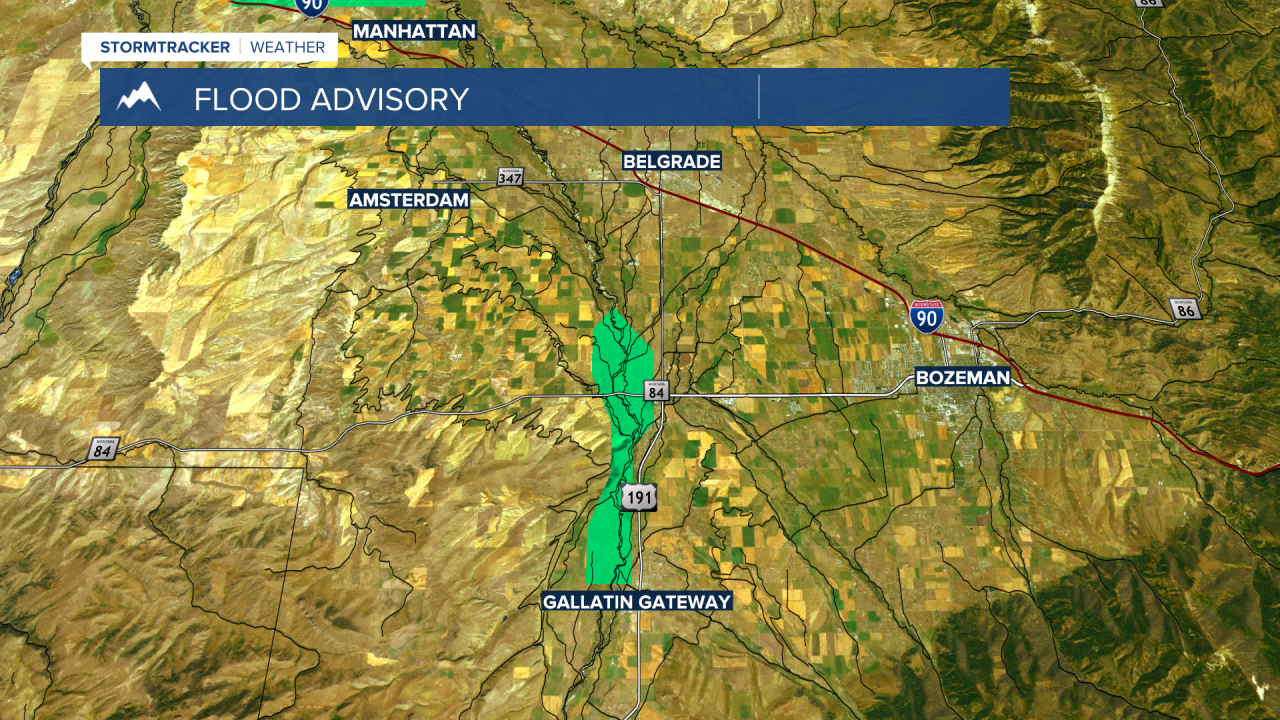
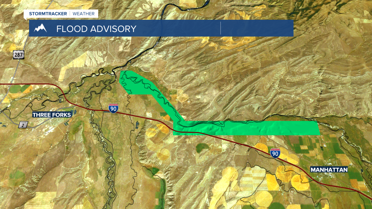
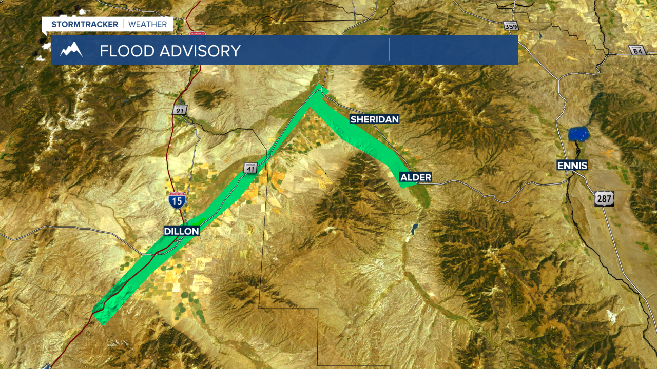
Another weather-related issue today is ice jam flooding. There are FLOOD ADVISORIES up for the Beaverhead and Ruby rivers. New advisories were issued for the Gallatin River from Gallatin Gateway to just north of Four Corners and for the Gallatin River near Manhattan into Headwaters State Park.