


BOZEMAN – Major flooding is impacting several river systems across the state. Locally, the Gallatin River and Yellowstone River are the two river systems that have flood warnings in effect for several more days.
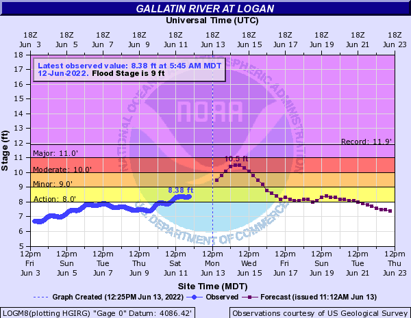
The National Weather Service has a FLOOD WARNING up for the Gallatin River near Big Sky downstream through Logan. Minor to moderate flooding is likely over the next 2 days with water levels possibly receding below flood stage by the end of the week.
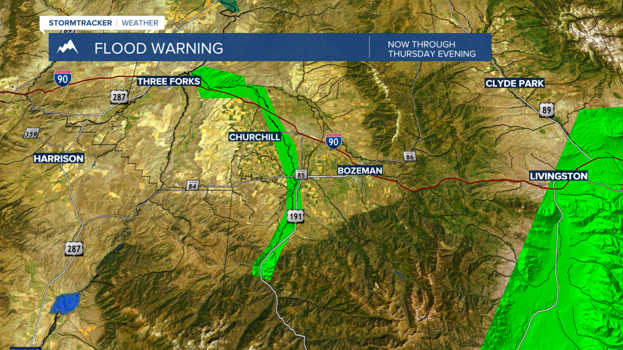
The Gallatin River at Logan could reach 10.5’ by Tuesday and that will put that area in the “moderate” flood range. The same between Big Sky and Gallatin Gateway, the river there could reach 7.2’ by Tuesday and that is also in the “moderate” flood range.
The Yellowstone River from Yellowstone National Park through Billings is under a FLOOD WARNING through Wednesday evening. This river system has seen historically high-water levels.
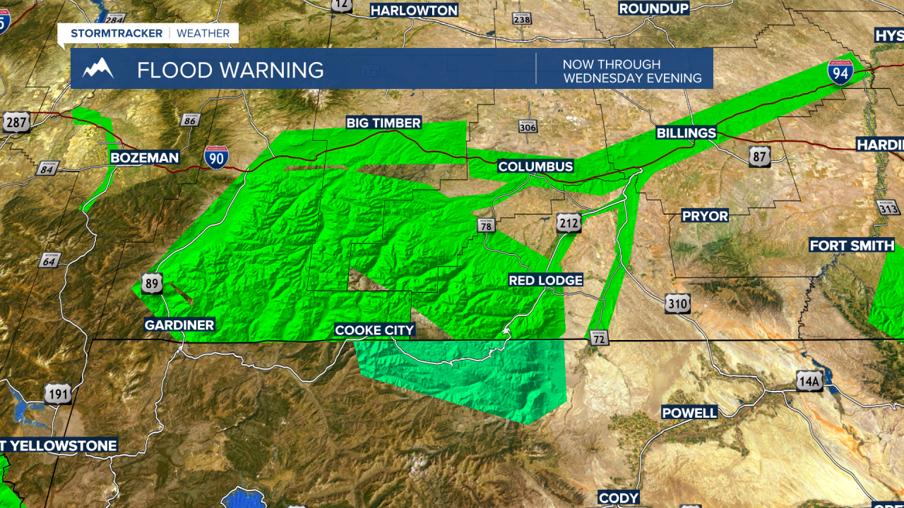
At Corwin Springs the river has peaked at 13.69’ Monday morning surpassing the old historic record of 11.5’. At Livingston the Yellowstone River peaked at 10.84’ Monday morning surpassing the old record of 10.7’.
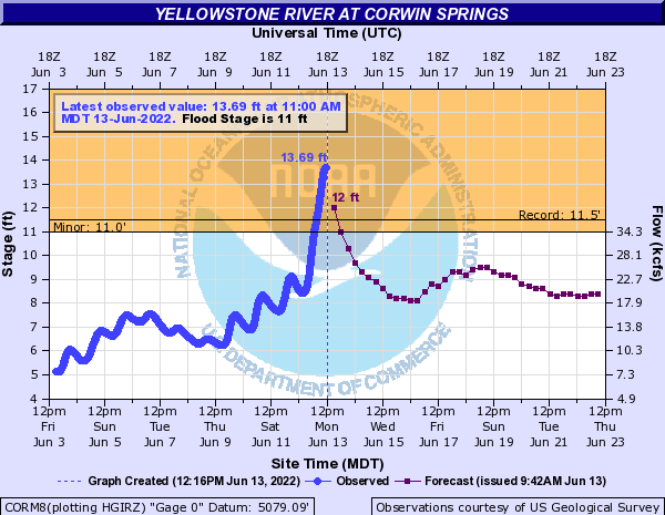
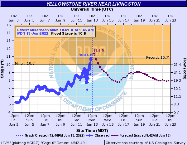
The good news here is the forecast river levels should drop off sharply by Wednesday and fall below flood stage by mid-week.
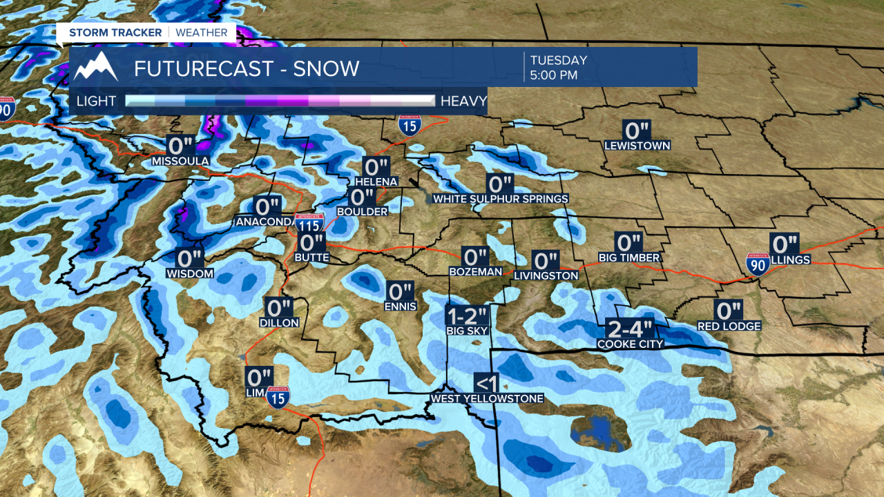
The weather forecast has just a little more rainfall through Tuesday for SW Montana and there is a good chance for mountain snow Monday night into Tuesday above 5,000’. Snow accumulations will be highly varied with an inch or two around 5,000’ and possibly 6” or more above 8,000’.
As the current storm slowly spins across the hi-line of Montana with more heavy rain along the Montana and Canadian border with southern end of the storm is not as impressive for moisture. This Low-pressure system will continue to push up into Canada and exit the region by Thursday.
Replacing this storm will be a rapid warm up with High-pressure moving into the state and temperatures could shoot up into the 80s and a few lower 90s by Friday.
