BOZEMAN – Unseasonably warm and very windy for the first day of November. Normal daytime temperatures are in the mid to upper 40s for November 1st, but today most highs reached the mid 50s to the upper 60s.
That will not last much longer as a deep trough of Low-pressure is now pushing into the Pacific NW and this trough will slide through Montana Wednesday into Thursday producing cooler temperatures, more wind, a little rain or snow for the lower valleys and a better chance for accumulating snow for most local mountain ranges.
The NW corner of Montana has the highest probability of moderate to heavy snow and there are a few Winter Storm Warnings and Winter Weather Advisories for the Glacier National Park area and along the Rocky Mountain Front.
At this time there are no winter weather highlights up for SW Montana. Mountains and passes will see periods of snow tonight through Thursday morning locally and if you are traveling be prepared for wintry conditions.
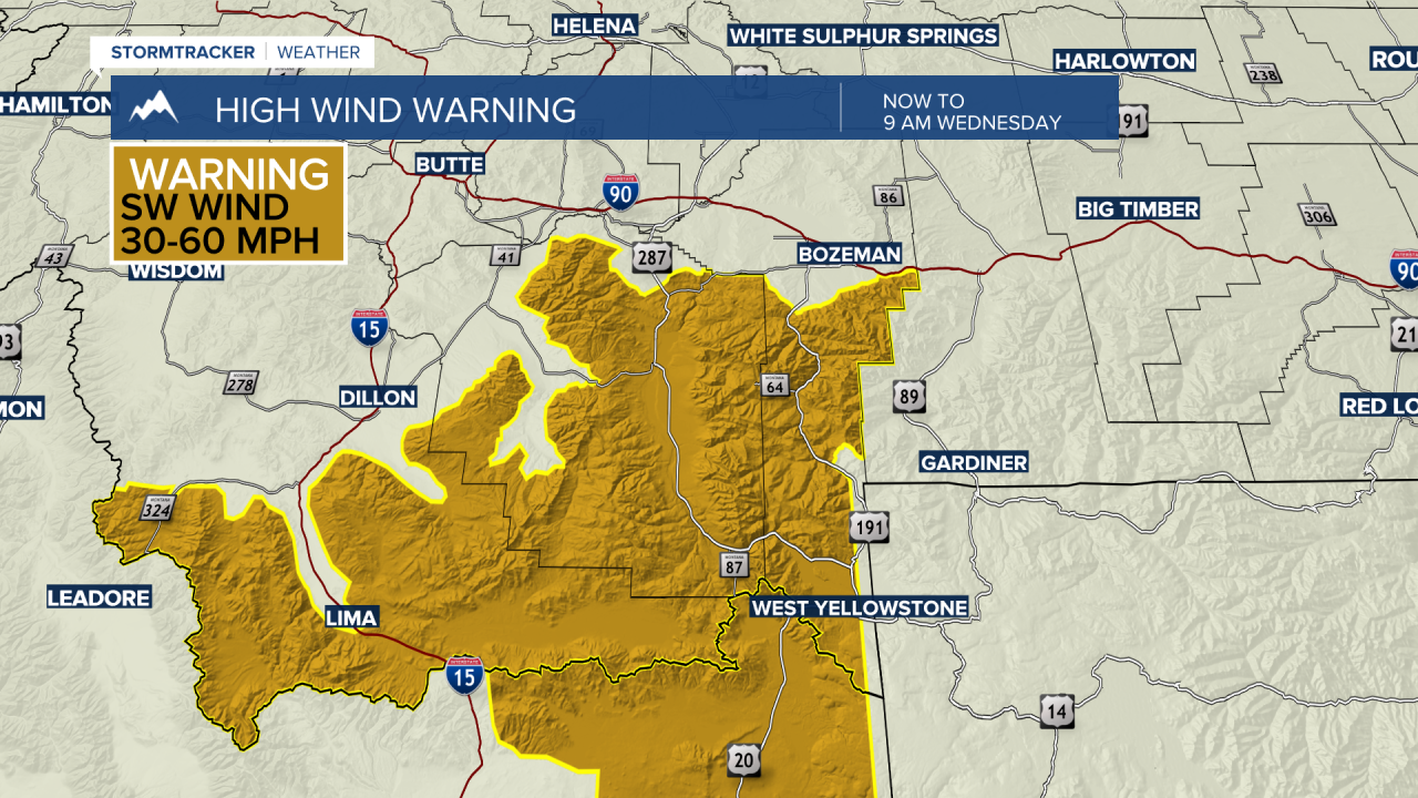
The greatest threat for SW Montana is damaging wind gusts. A HIGH WIND WARNING is up across Beaverhead, Madison, and Gallatin Counties down into Eastern Idaho. Peak gusts up to or over 60 mph are possible through Wednesday late morning. Property damage is possible and the high wind threat is a concern for high profile vehicles.