


BOZEMAN – High-pressure is building over the western U.S. today and slowly expanding into Montana. This blocking pattern will keep our weather pattern mostly dry through the weekend and possibly into most of next week.
This blocking ridge will also produce warming temperatures which started Tuesday afternoon, but a bigger jump is coming on Wednesday. Temperatures should remain near to well above normal through the weekend into most of next week.
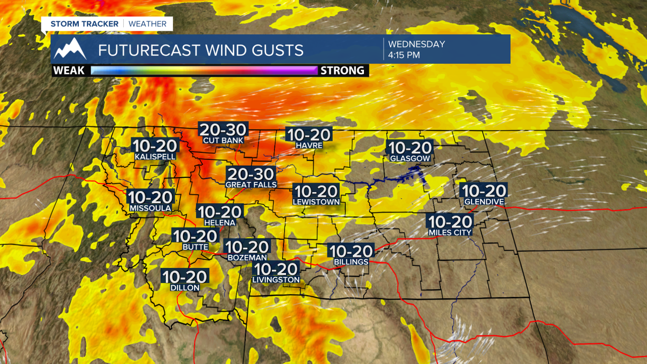
Most Pacific storms will be forced to move up and over the ridge pattern but a few cold fronts clashing with ridge could produce gusty wind Wednesday afternoon and again on Saturday afternoon. The short-term forecast has the strongest wind gusts Wednesday along the Rocky Mountain Front and Hi-line region. SW Montana could see afternoon surface winds around 10 to 20 mph with stronger gusts in high wind prone areas.
We will also keep an eye on wildfire smoke for the rest of the week. Right now, skies are clear of smoke and air quality is mostly good. A stronger SW flow aloft with warming temperatures could allow wildfire smoke from as far away as California to drift into SW Montana later this week and possibly this weekend.
