


BOZEMAN – Cool and very windy today for SW Montana. Peak wind gusts of 30 to 50 mph are possible through sunset tonight.
A slow moving and powerful upper-level Low is spinning over NW Montana today and that is where most of the moderate rain and mountain snow is developing with a few weak bands of moisture rotating down here in SW Montana.
There have been some minor periods of snow north of Butte in Elk Park with no accumulations so far.

The Butte/Blackfoot region continues to be under a WIND ADVISORY through 9 pm Tuesday. Strong West winds 20 to 40 mph and peak gusts up to 50 mph are still possible.
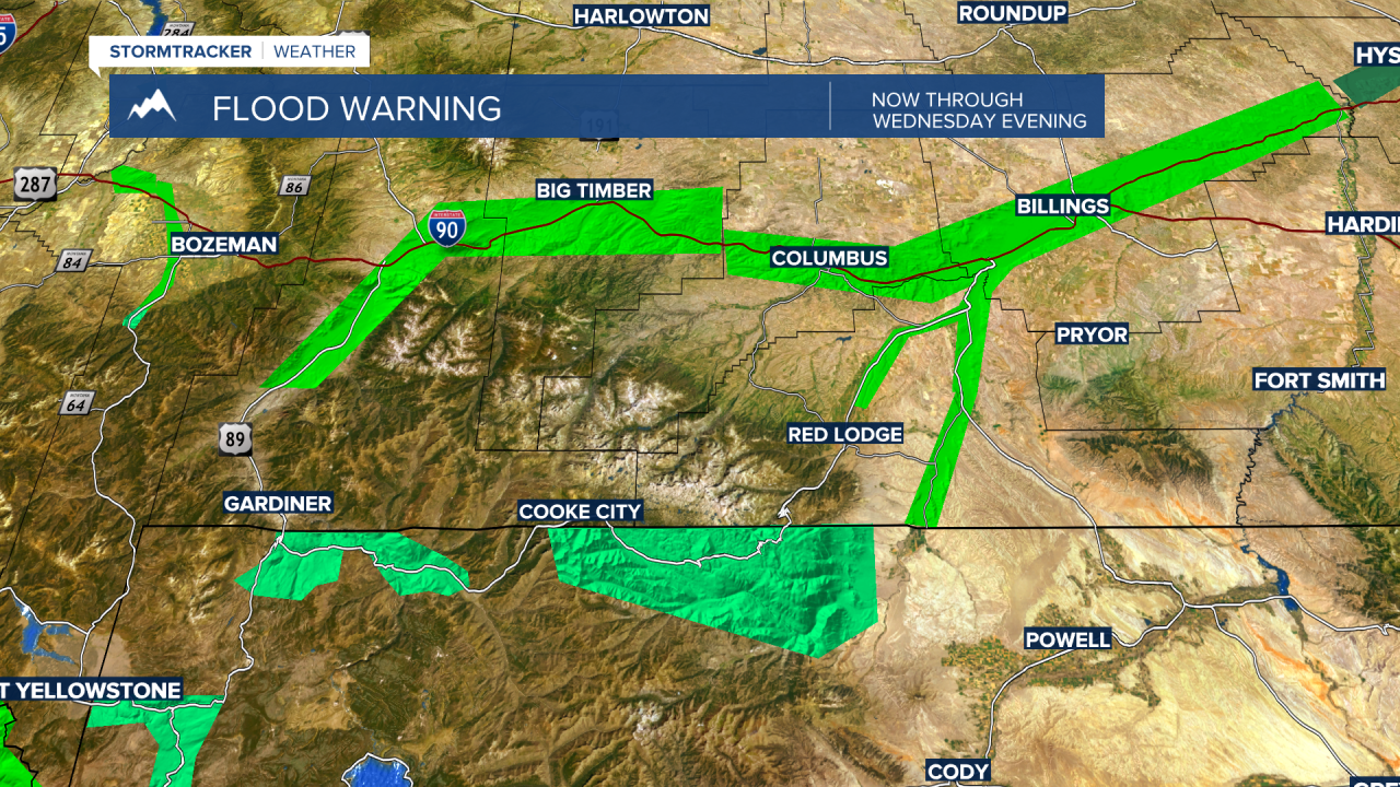
Flooding is ongoing in the same areas as Monday. The Gallatin and Yellowstone River systems continue to flow out of their banks.
The National Weather Service continues a FLOOD WARNING for the Gallatin River from Gateway downstream to Logan. The warning is through Wednesday evening near Gateway but continues through Thursday morning for the Logan area.

The National Weather Service has cancelled the flood warning along the Yellowstone River near Gardiner but continues the FLOOD WARNING from Livingston through Billings until Wednesday afternoon.
The next weather maker will be a rapid warming trend with temperatures rising into the 80s and few lower 90s by Friday.
This could create another round of high water with melting snowpack by the weekend, but at this time, there are no flood highlights issued for SW Montana. We will continue to monitor the forecast and please check back in frequently for updates.
