


BOZEMAN – Heads up! Tonight will be one of the coldest nights of the current winter season for SW Montana.

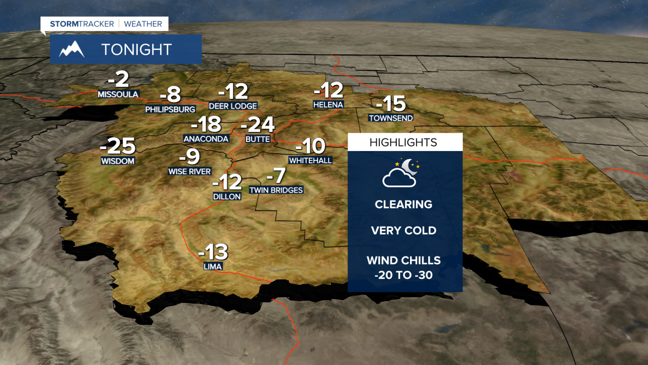
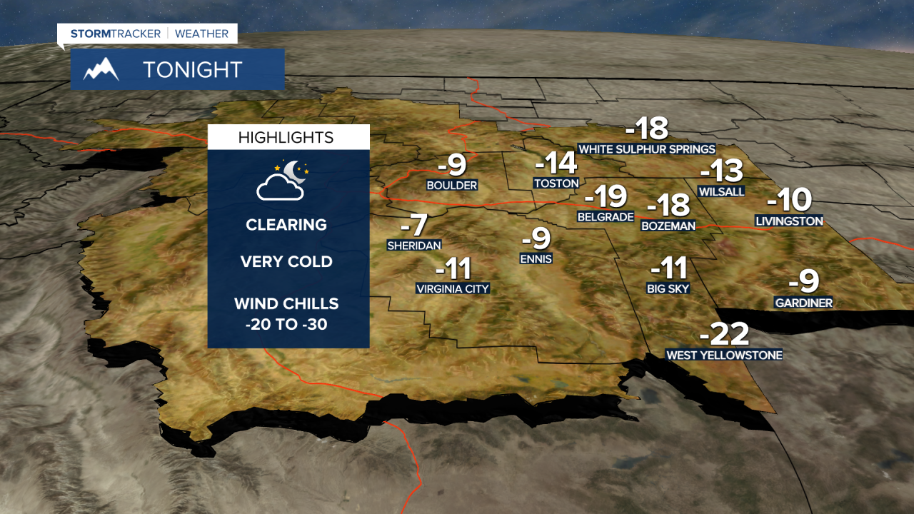
Clearing skies will allow cold dense air to dig deeply into the valley floor forcing temperatures well below zero tonight for the entire state of Montana. SW Montana will likely see morning lows between –10 to –25 degrees below zero.
A light 5 to 15 mph wind will be enough to produce feels like temperatures between –20 to –30 degrees below zero or colder. This means frostbite is possible within 10 minutes on exposed skin.
Here are the adjusted forecast lows for Saturday morning January 1, 2022 for SW Montana.
Temperatures will begin to moderate by Sunday and could be back up to normal levels by Monday. Increasing surface wind will help scrub out the cold pools that develop by Sunday but stronger surface winds will also produce areas of blowing snow and low visibility travel issues beginning Saturday and continuing into Monday morning.
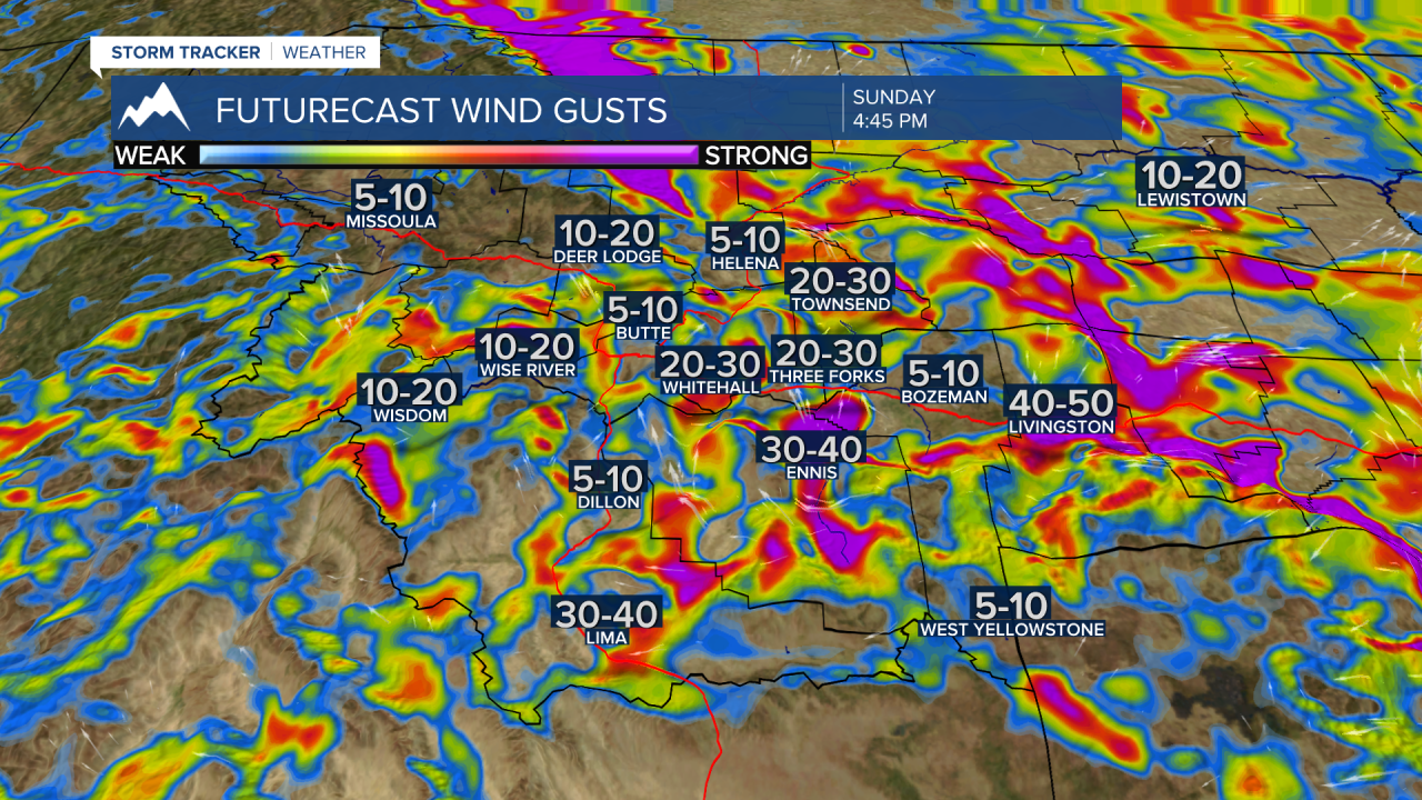
Wind prone areas could see gusts 20 to 50 mph at times Saturday afternoon through Monday morning and the Livingston area could see peak gusts up to 50+ mph. There is a lot of dry fine powdery snow on the ground and with wind gusts over 20 mph blowing snow and low visibility issues will develop for SW Montana.
Forecast wind gusts from Saturday afternoon through Sunday afternoon.


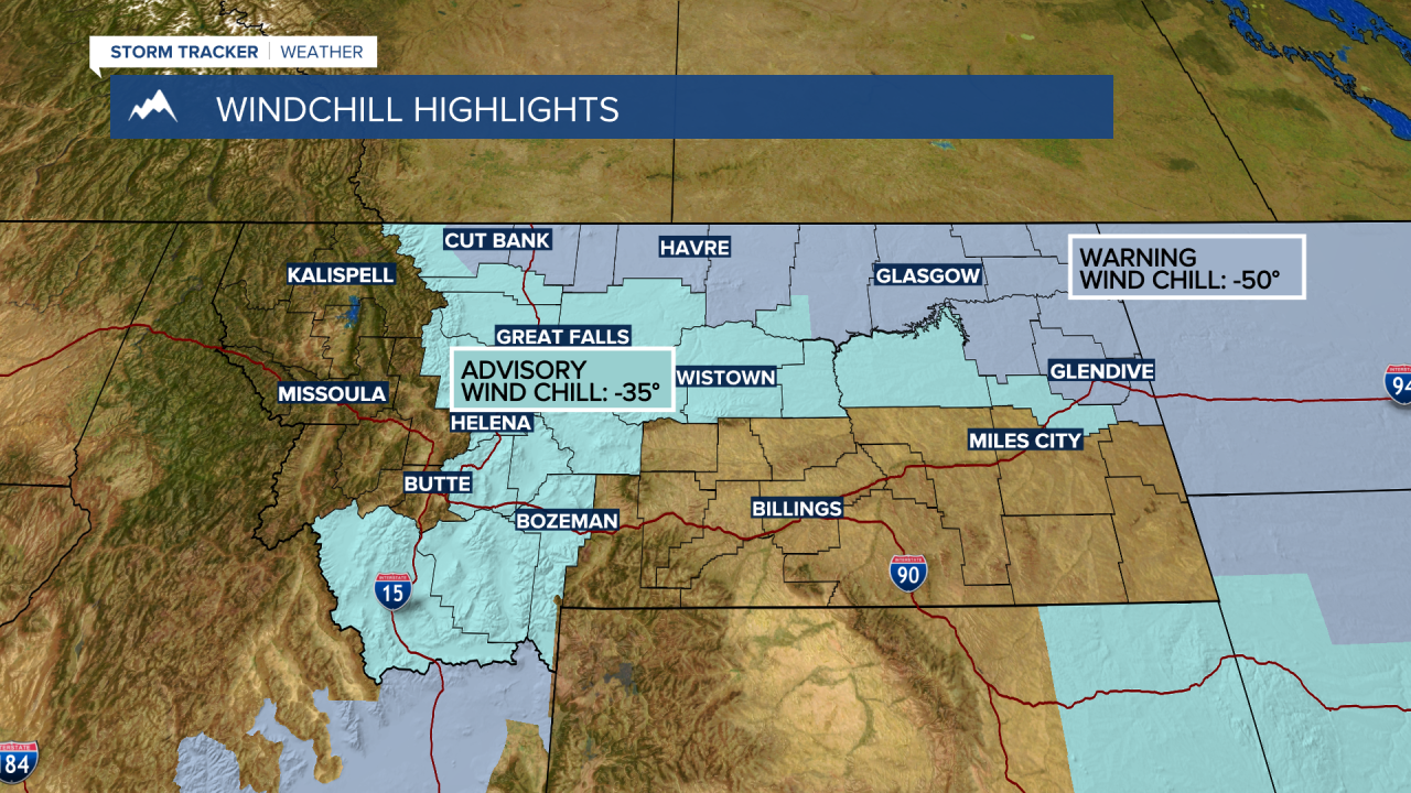
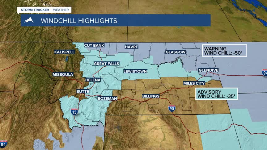
The National Weather Service has issued a WIND CHILL ADVISORY for SW Montana east of the divide Friday night through 11 am Saturday. Feels like temperatures –20 to –30 degrees below zero or colder are possible and frostbite within 10 minutes.