


BOZEMAN – Friday afternoon through early Friday evening fire weather concerns is developing over most of Montana.
A RED FLAG WARNING continues through 9 pm Friday night for all of SW Montana.
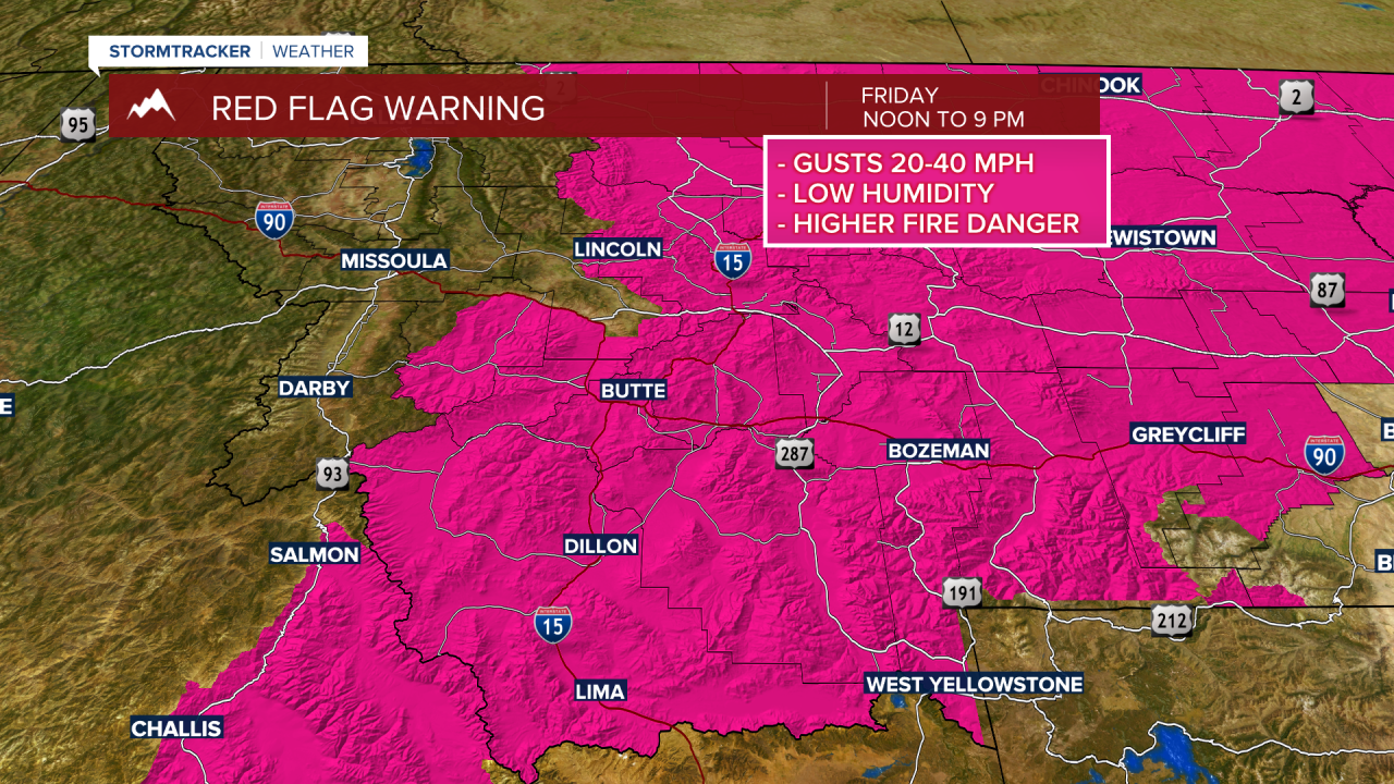
The reason for the critical fire weather forecast is due to increasing surface wind gusts. Peak gusts 20 to 40 mph are possible especially in wind prone areas with sustained afternoon surface winds around 10 to 20 mph.
Lower relative humidity, hot temperatures, and gusty surface winds will produce extreme fire danger. Human caused fires are the greatest concern during Red Flag Warnings as a small fire can quickly grow out of control. Existing fires also have a good chance of significant growth.
Monsoonal moisture should stay well south of Montana through the weekend. Afternoon and evening thunderstorms over the last three days will not continue into the weekend.
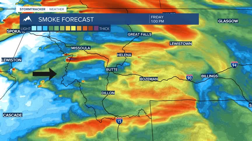
Flow aloft is out of the West to SW and this will pave the way for wildfire smoke from large fires in Oregon to push up into western and SW Montana. Air quality conditions will be terrible at times this weekend and unhealthy if you plan to be outdoors for long periods of time.

