


BOZEMAN – A blast of wintry weather will impact travel conditions across Montana and Wyoming beginning Wednesday evening through Friday afternoon.
There are numerous winter weather highlights for snow and wind locally in SW Montana. Thursday will be the higher probability for snow and wind day with much colder temperatures behind the storm by Friday.
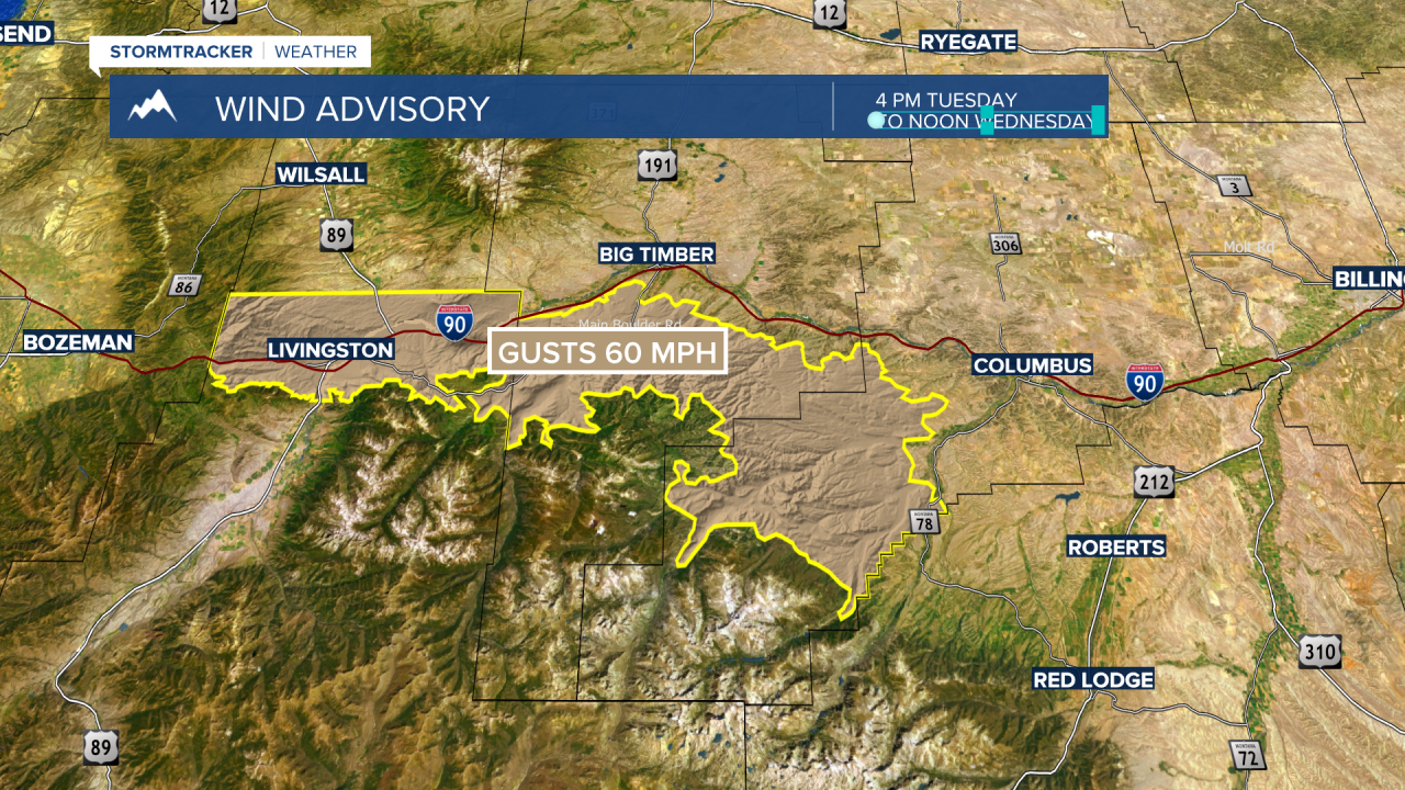
The National Weather Service issued a WIND ADVISORY for the Livingston area from 4 pm Tuesday to Noon on Wednesday with peak gusts of 60 mph possible. Although the advisory expires at noon Wednesday more wind with snow is likely Wednesday night into Thursday for the Livingston area.
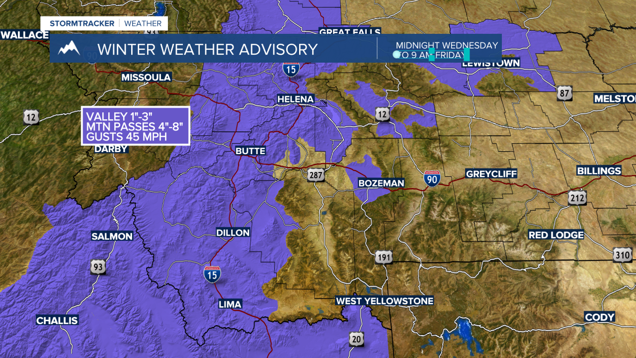
The National Weather Service issued a WINTER WEATHER ADVISORY for most of SW Montana Wednesday night through Friday morning, with snow accumulations around 1”-3” for most lower valleys and over 3” for most mountain passes. Wind gusts up to 40 mph are possible and this could produce areas of blowing snow and lower visibility.
The National Weather Service has a WINTER STORM WATCH up for most of southern Montana and most of Wyoming Wednesday evening through Friday afternoon. This means conditions are looking favorable for moderate to heavy snow and gusty winds.

Mountains could see 6”-12” of snow and gusts to 40+ mph. The I-90 corridor from Bozeman to Billings is also included in the Winter Storm Watch and there is a very good chance for snow and blowing snow and icy road conditions Wednesday night through Friday morning.
