


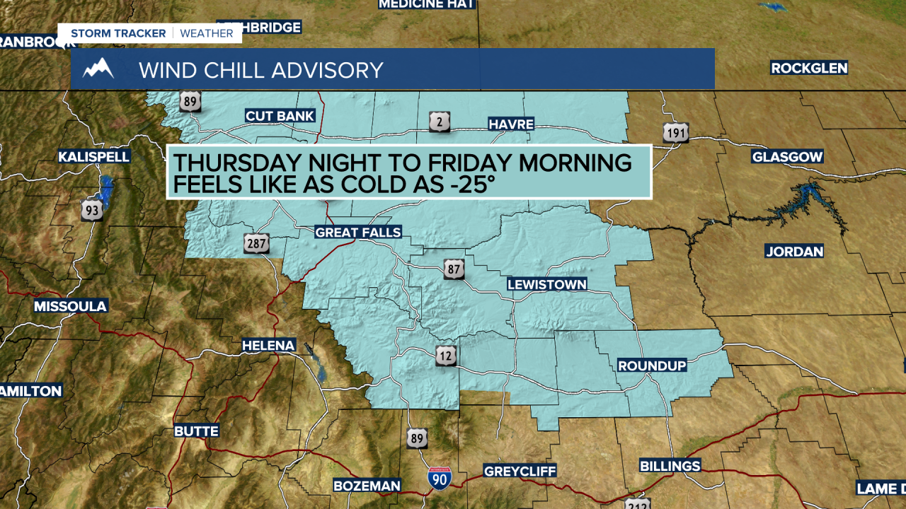
BOZEMAN – A cold and unsettled weather pattern will continue into Friday. In fact, some of the coldest temperatures of the month will impact Montana especially east of the divide with bitter wind chills by Friday morning.
The National Weather Service continues a WIND CHILL ADVISORY for central Montana tonight into Friday morning. Wind chill values could be as cold as -25° below zero.
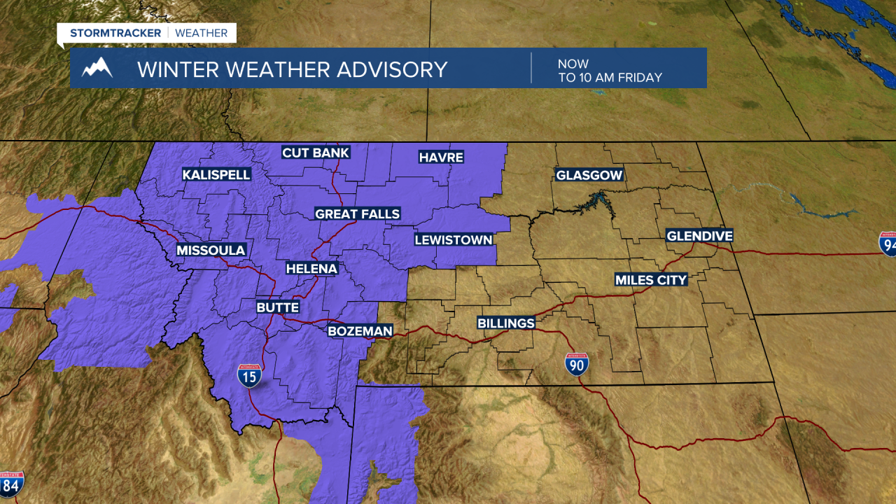
As the cold air digs south a weak and disorganized Pacific disturbance is pushing in from the west producing scattered snow showers and gusty winds. This will create wintry travel conditions Thursday night into Friday morning especially for mountain passes across western, central and SW Montana.
The National Weather Service issued a WINTER WEATHER ADVISORY for snow and blowing snow now through Friday morning. Snow accumulations around 1”-3” are possible for lower elevations and 1”-6” for mountain passes.

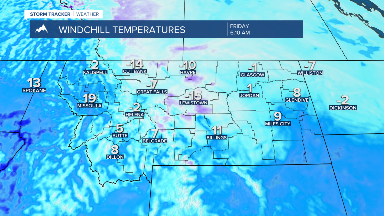
Temperatures will be below normal Friday with most of Montana east of the divide only reaching the teens to very 20s Friday. Saturday morning will start off with local low minimum temperatures in the very low single digits but a warming trend will begin by Saturday afternoon.
