

BOZEMAN – When strong High pressure collides with a strong cold front you get strong wind gusts.
That is the pattern Wednesday afternoon.
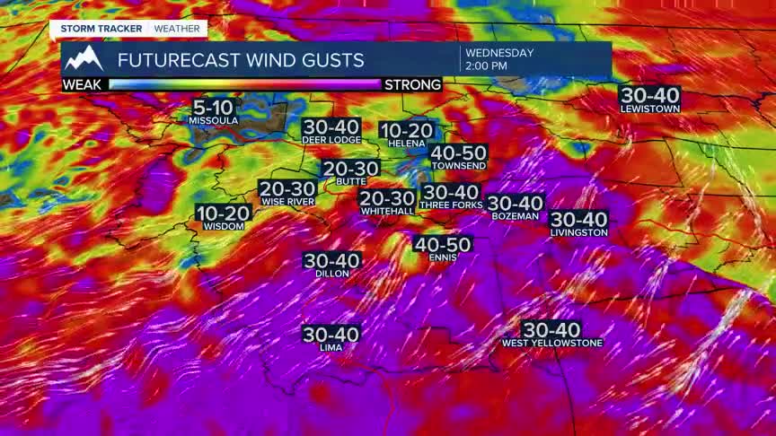
The National Weather Service has issued a WIND ADVISORY for the Butte-Blackfoot Region noon to 9 pm Wednesday. SW wind sustained 20 to 40 mph with peak gusts up to 55 mph are possible.
The National Weather Service has issued a HIGH WIND WATCH (likely will be upgraded to a warning) for SW Montana east of the divide Wednesday afternoon into Wednesday evening. SW wind sustained 20 to 40 mph with peak gusts up to 60 mph are possible.
The combination of pre-frontal warming, low humidity and strong wind gusts is the prime recipe for new wildfire starts. For that reason, a RED FLAG WARNING is up for SW Montana Wednesday afternoon into Wednesday evening. Please use extreme caution with all outdoor activities to avoid accidental new wildfires.
A cold front will pass through the region Wednesday evening and behind that front cooler air by Thursday. There is only a slight chance for isolated showers or thunderstorms with this front Wednesday afternoon into Thursday morning. Most of the moisture will clip far western and NW Montana.
Another shot of colder air is coming by Sunday with scattered rain and mixed precipitation for higher elevations.
