


BOZEMAN – Scattered mainly mountain snow showers are pressing through the region Wednesday afternoon impacting travel for a select mountain passes.
The next weather maker will be a clipper type storm dropping in from Alberta and another quick shot of snow and wind is likely across the state mostly east of the divide.
This could impact Friday morning commutes for the eastern half of SW Montana, around Bozeman and Bozeman Pass over to Livingston up to White Sulphur Springs.

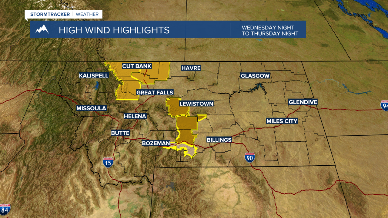
Ahead of the front surface wind gusts will be very strong along the Rocky Mountain Front down into the Livingston area. The National Weather Service has issued a variety of warnings, watches and advisories. Regardless, of the type of statement wind gusts up to or over 60 mph are possible in areas highlighted in the maps below.
By the weekend a mild and dry pattern returns, and temperatures will once again shoot above normal.
