


BOZEMAN – An active pattern will continue this weekend into early next week as 2 cold fronts will push through the region.
The first cold front will be passing through quickly Saturday afternoon into early Saturday evening. This front will produce scattered valley rain and higher mountain snow showers Saturday afternoon. Snow accumulations are likely above 6,000’ but no travel hazards are anticipated for SW Montana.

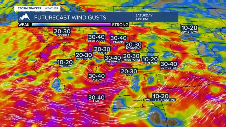
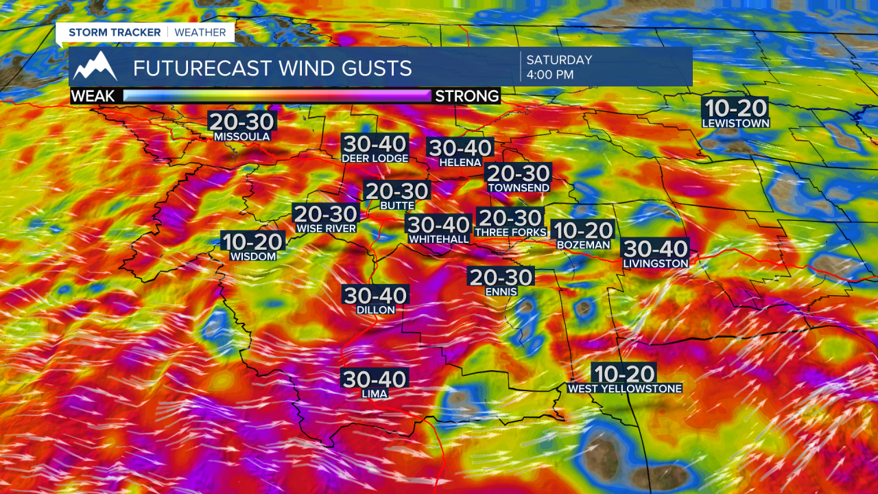
Stronger surface wind gusts will also develop ahead and along the frontal passage Saturday. In high wind prone areas peak gusts over 40 mph are possible. Otherwise, sustained surface wind will be in the 10 to 30 mph range Saturday afternoon. Sunday look for localized gusty winds more so in wind prone areas.
The second cold front will arrive Monday afternoon and produce another round of valley rain and higher mountain snow along with very windy conditions through Tuesday. Temperatures will be much cooler on Tuesday, but this cool snap should be short-lived as a significant temperature rise is in the forecast for late next week.
