


BOZEMAN – An Arctic cold front has passed through the entire state of Montana this morning. Snow was widespread with the frontal passage and now the cold digs deeply into the lower valleys behind the front.
The biggest hazard will be the extremely cold temperatures under clear skies Thursday night into Friday morning and wind chill values cold enough to produce frost bite within 30 minutes.
The National Weather Service has issued a WIND CHILL ADVISORY for SW Montana east of the divide Thursday night into Friday morning. There could be additional highlights issued later today west of the divide, check your STORMTracker Weather mobile app for updates.
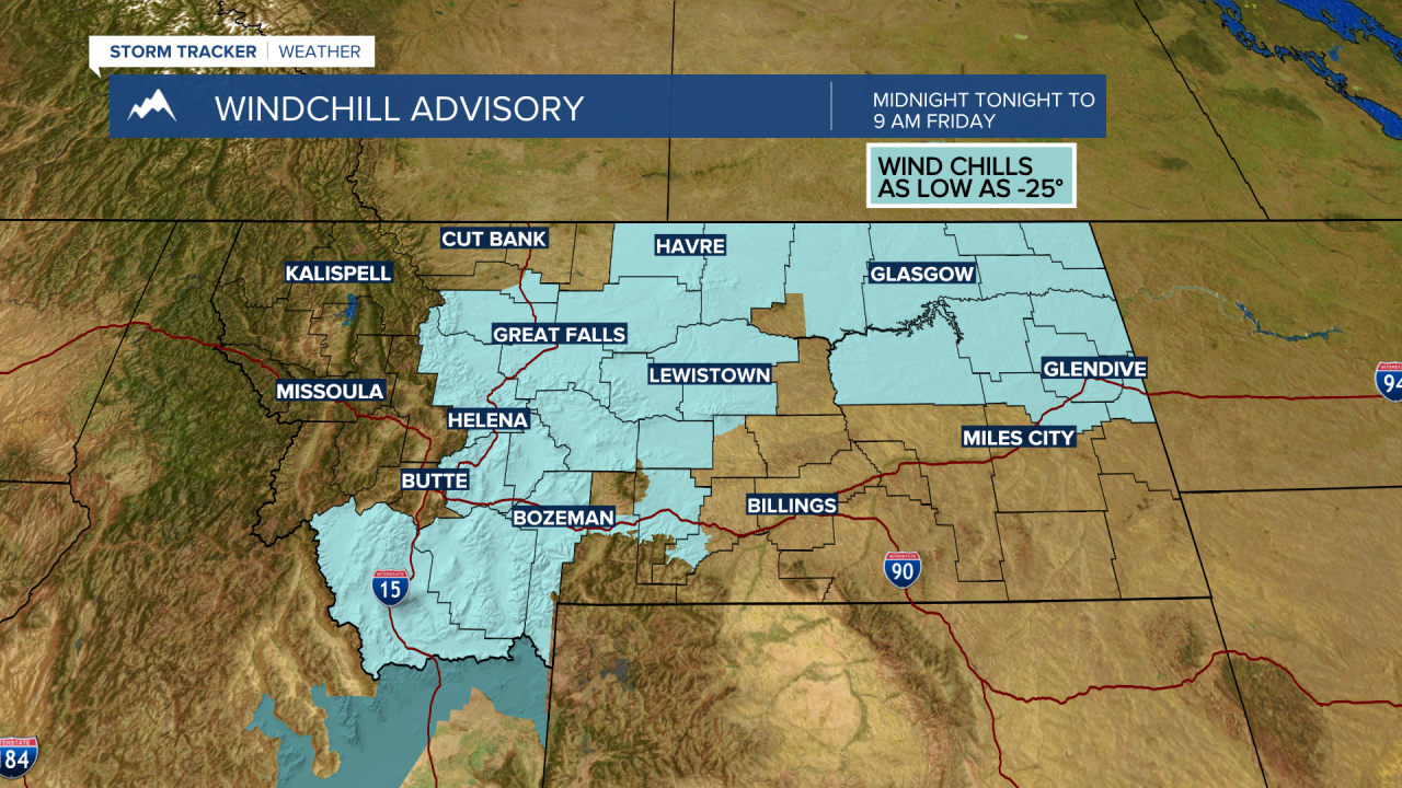
Wind chill values could be as cold as minus 25 degrees or colder. This means frostbite is possible within 30 minutes. Please try and limit your exposure to the bitter wind chills as much as possible tonight and Friday morning.
Forecast lows (not wind chills) will vary from –5 to –25 Thursday night into Friday morning across SW Montana. A very light 5 to 10 mph breeze will create very cold wind chills.


Temperatures will be very cold all day Friday and drop below zero again Friday night into Saturday morning, although not as cold as Friday morning.
A slow warming trend begins Saturday afternoon with temperatures reaching normal levels by early next week. Good news is the forecast is milder for Thanksgiving.
