


BOZEMAN – The storm keep on coming and this next system will look a lot like the last one back on Friday.
Another Pacific cold front to plow through the Pacific NW and Northern Rockies Monday night into Tuesday and more wind and heavy snow is in the forecast.
Hardest hit areas will be once again along the MT/ID state line. Monida Pass over to West Yellowstone will see periods of heavy snow and wind gusts 40 to 60 mph. This has the potential to force road closures again. Check the road reports in Montana and Idaho before you travel.

This cold front will pass through quickly and should be exiting SW Montana by Tuesday afternoon. A deep plume of subtropical moisture is aiming at central California and some of that moisture will try and spin up into Idaho and Montana through Thursday which will keep off and on snow bands moving through with the potential for more moderate to heavy mountain snow.
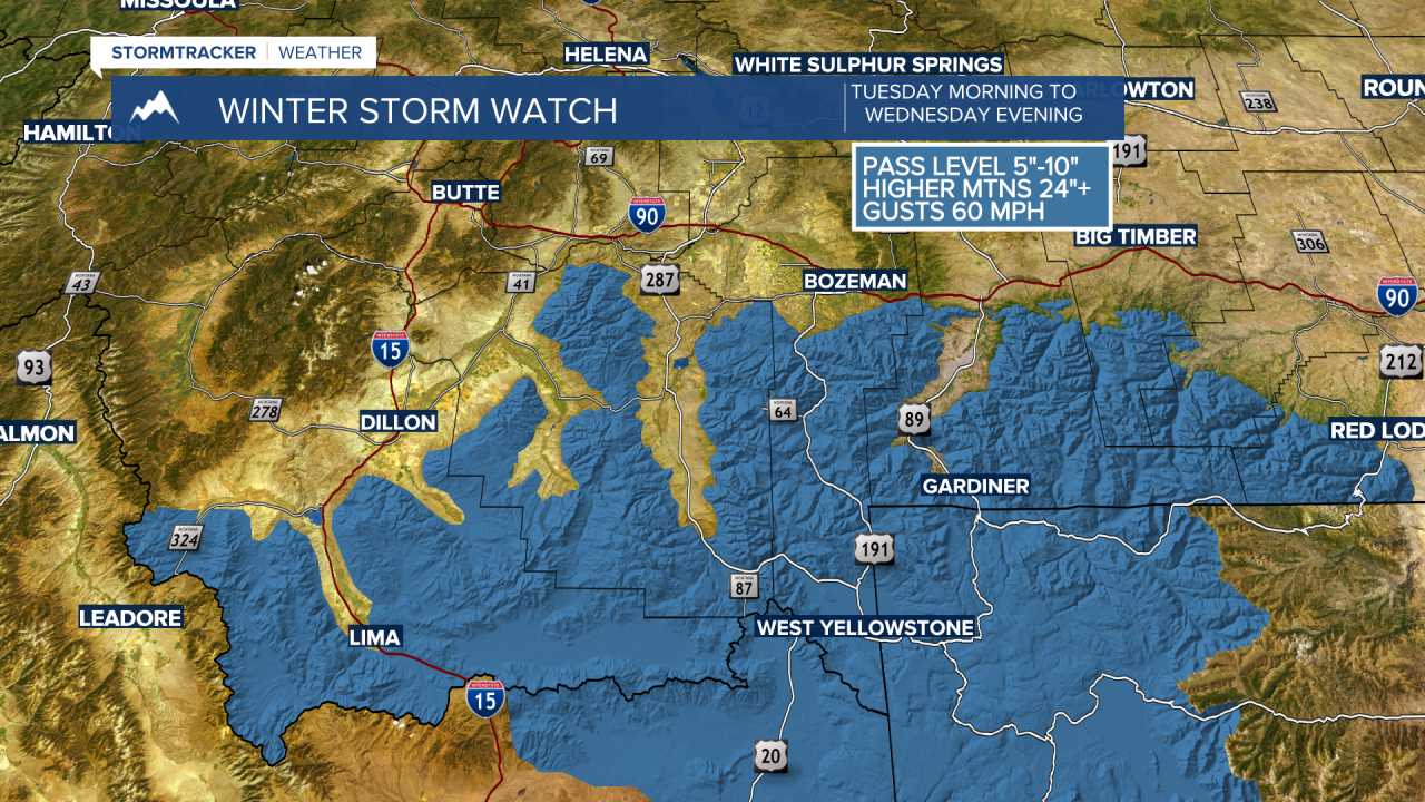
The Nationial Weather Service issued a WINTER STORM WATCH (likely to be upgraded to a winter storm warning later today) is in effect from Tuesday morning through Wednesday evening.
Snow totals at pass level could be around 5”-10” and above pass level up to 2’ feet of snow is possible. The other side effect will be very strong surface wind gusts up to or over 60 mph which will produce white out and dangerous travel conditions especially over Monida Pass over to Island Park, ID.
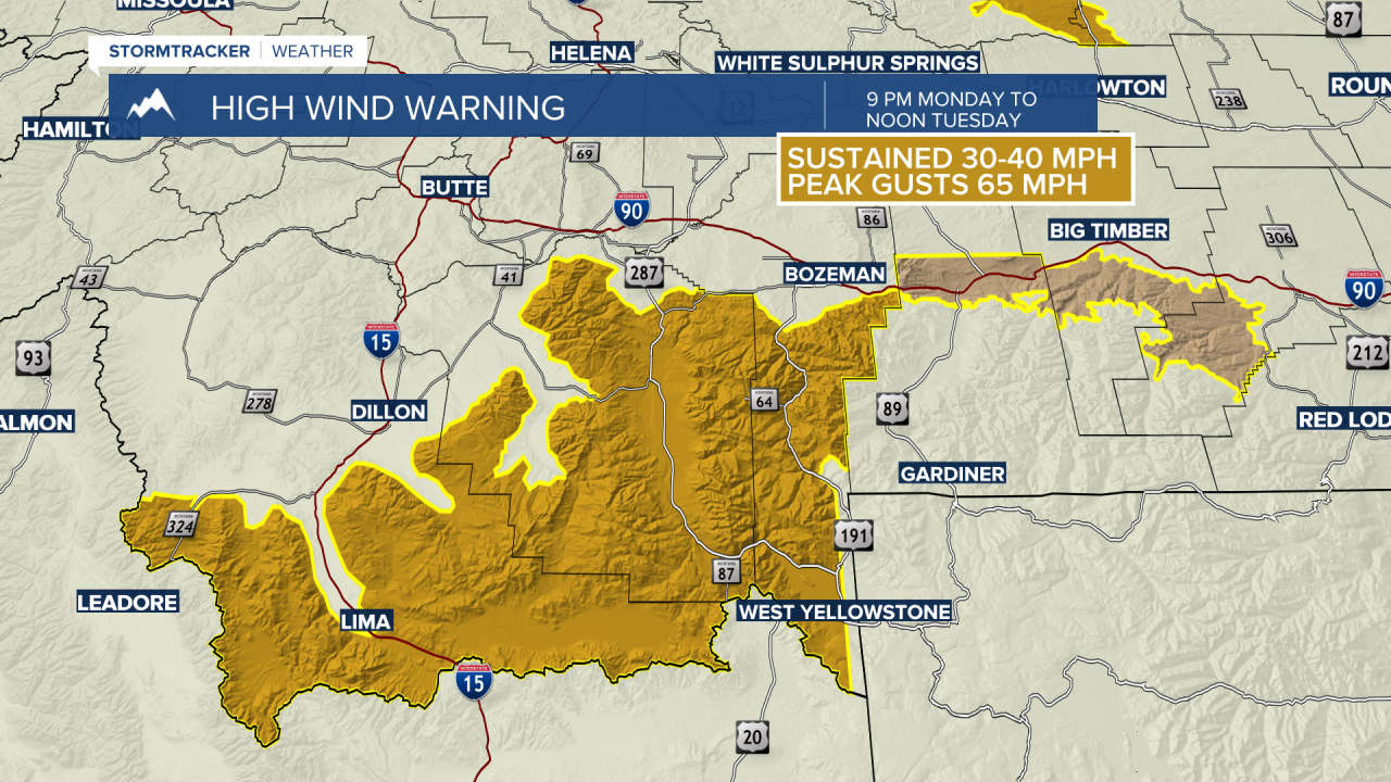
The National Weather Service has issued a HIGH WIND WARNING across Beaverhead, Madison, and Gallatin Counties from 9 pm Monday to noon Tuesday.
Sustained wind 30 to 40 mph and peak gusts up to 65 mph are possible especially in high wind areas like Monida Pass, Ennis to Norris Hill, Raynolds Pass.
The National Weather Service issued a WINTER WEATHER ADVISORY for far western Montana including Lookout Pass from midnight Monday to 9 am Tuesday.
Valleys could see 1”-3” with 3”-6” at pass level along with wind gusts to 40 mph.

