


BOZEMAN – A weak disturbance is passing through Montana east of the divide producing scattered snow showers with the greatest impacts over central and southcentral counties of Montana.
Winter Weather Advisory is up through Tuesday morning for the Little Belt, Highwood, Snowy, and Judith ranges in central Montana. This advisory is also up for the southern Big Horn ranges with I-90 east and south of Billings.

These areas could see another 1”-3” inches of snow for lower elevations and 3”-6” or more for mountains and passes.
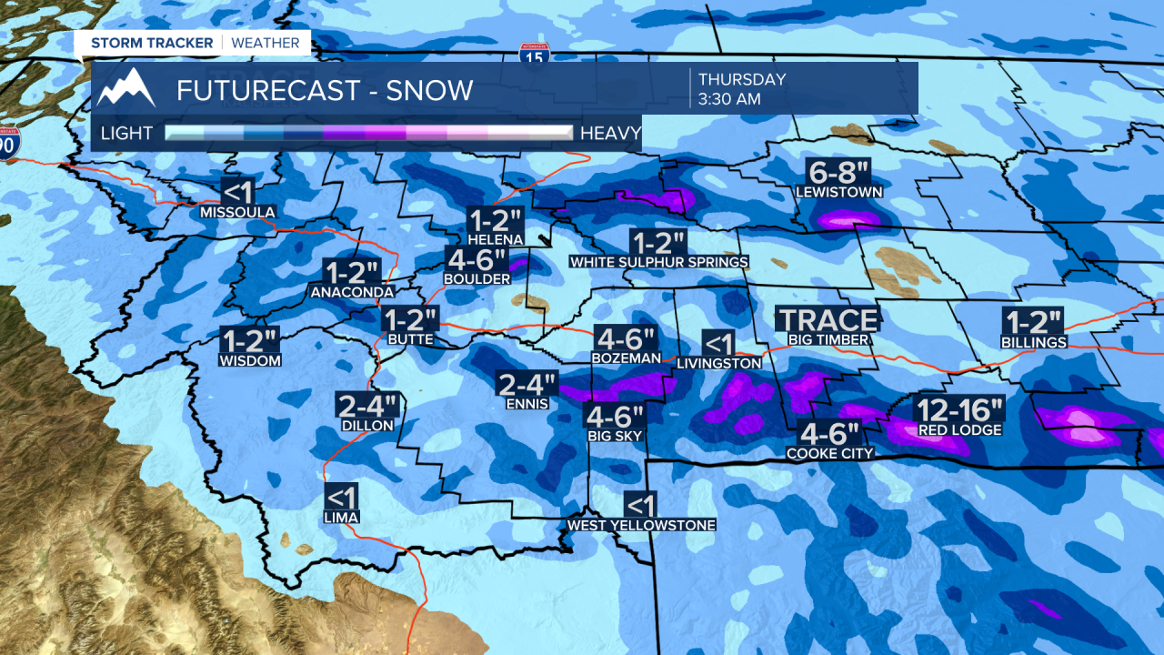
The next weather maker will bring another round of snow and another shot of Arctic air. This next cold front will arrive late Wednesday into Thursday morning. Widespread snow is possible both west and east of the divide. Areas of blowing snow are also possible.
Behind this front temperatures will fall below zero again by Friday and Saturday morning. Temperatures will continue to stay below normal through the next 10 days.
