


BOZEMAN – An active weather pattern will impact most of the western U.S. including Montana through the next 10 days.
Several Pacific storms will bring periods of rain, snow, and strong surface winds to SW Montana. Travel at times will be impacted and plan on snow and ice over mountain passes especially along the MT/ID state line.
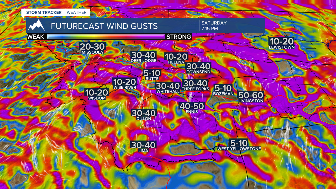
A deep trough of Low-pressure will dig down the west coast starting Friday. This will begin to strengthen the flow aloft out of SW and in turn produce above normal temperatures by the weekend, however, stronger surface winds will impact the entire region Friday through Sunday.
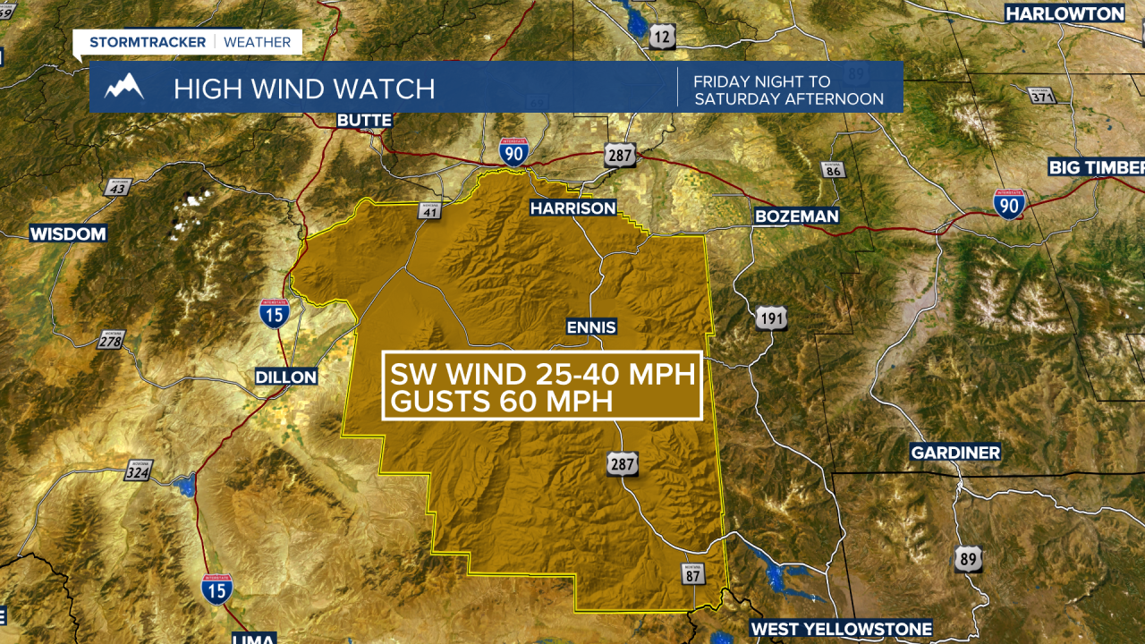
The National Weather Service has a HIGH WIND WATCH up for Madison County in SW Montana Friday afternoon through Saturday evening. Sustained wind 25 to 40 mph and at time peak wind gusts up to 60 mph are possible. This could produce property damage, power outages and areas of blowing snow.
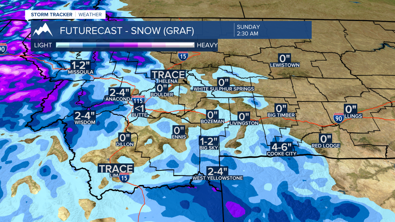
The strong SW flow aloft will also transport moisture through central and northern Idaho and push mountain snow bands through SW Montana impacting the Wisdom, Wise River, Anaconda areas and between Big Sky to West Yellowstone over to Cooke City with periods of snow and gusty winds.
Mountain passes like Lookout Pass could see heavy snow at times this weekend and look for snow and wind through Island Park, ID to West Yellowstone.
A cold front will pass through the state Tuesday into Wednesday of next week producing widespread areas of snow and wind with wintry travel impacts likely. In fact, there will be a series of Pacific storms producing snow and wind late next week into the third weekend in December.
