BOZEMAN - Blocking High-pressure will lock us into a warm and dry pattern through the weekend. Temperatures will be above normal both at night and during the day. Forecast highs are in the 60s for most of SW Montana this weekend. Record highs this time of year are mostly in the low to mid 70s so at this time we don't anticipate shattering any records locally in SW Montana.
This pattern will break down by early next week as a large upper-level trough enters the region producing slightly cooler temperatures and scattered showers especially Tuesday and Wednesday of next week.
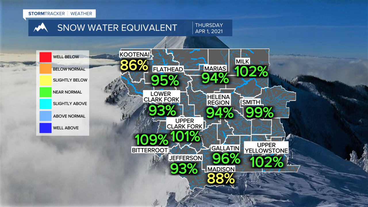
This unseasonably warm pattern is likely to melt some of the statewide snowpack and forcing smaller streams and creeks to rise into early next week. Flooding is not anticipated but be careful around streams if you are out recreating this weekend.
Today's mountain snowpack is holding near normal for most river basins. The Madison river basin is slightly below normal today. The current forecast is not good as above normal temperatures will begin melt some of the mountain snowpack especially in the mid-level foothills for example.