
UPDATE:
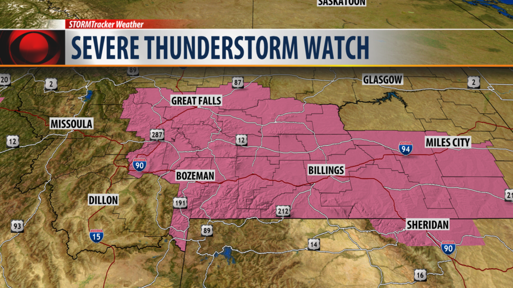
A Severe Thunderstorm WATCH has been issued for most of Montana east of the divide through 10 pm Wednesday evening.
Damaging thunderstorms with hail up to or over 1″ in diameter and/or wind gusts over 60 mph are possible with thunderstorms Wednesday afternoon and evening.
This includes: Jefferson, Broadwater, Meagher and Gallatin Counties in SW Montana.
BOZEMAN – Strong to severe thunderstorms are possible across Montana Wednesday afternoon and early evening and again Thursday afternoon and evening.
The Storm Prediction Center day one convective outlook has a “Marginal” to “Slight” risk for damaging thunderstorms in SW Montana mostly along and North of I-90.

SPC day two outlook has a “Slight” to “Enhanced” risk for severe storms from Butte to Glasgow Thursday afternoon and evening.


A Pacific storm system along with Gulf of Mexico moisture will collide over Montana leading to a very unstable atmosphere conducive for possible strong to severe thunderstorms over the next 48 hours. Late afternoon through early evening hours are prime time for storm development.
