


BOZEMAN – A pair of storms will continue to impact our local weather through the end of the week.

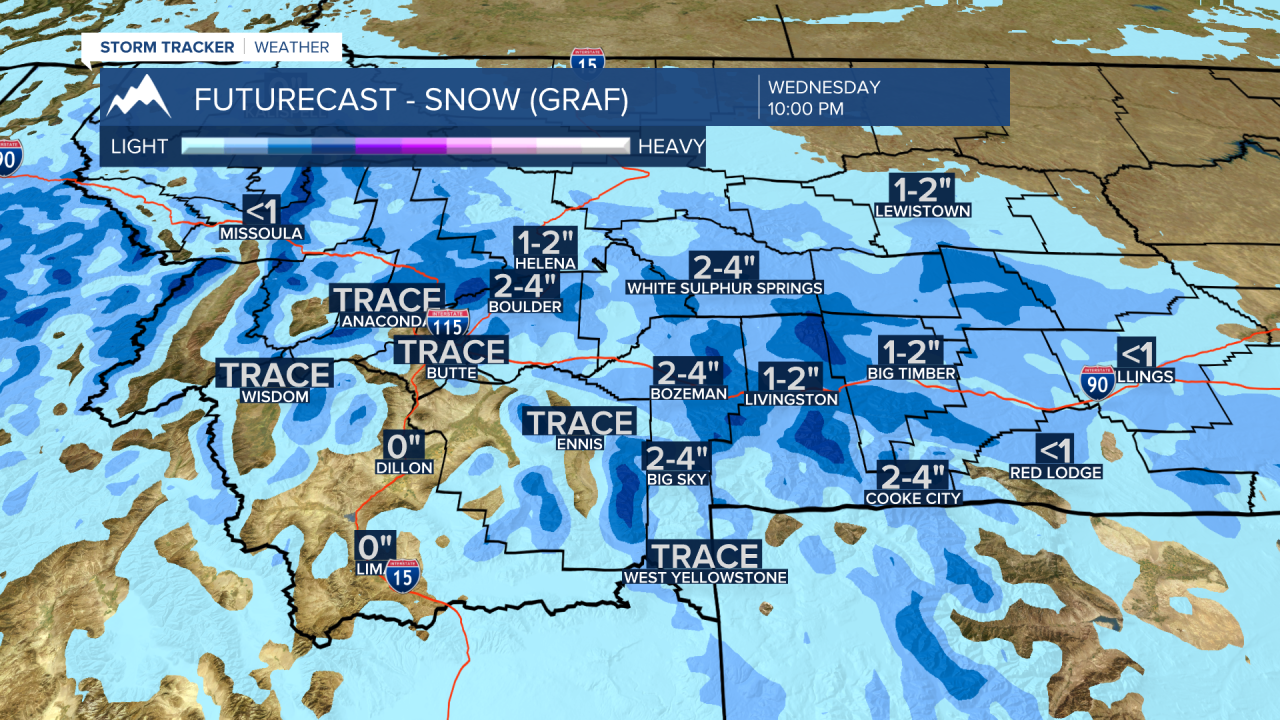
Storm #1 is an Arctic front diving into northern, eastern, and central Montana Tuesday afternoon. Scattered snow, much colder temperatures, below zero wind chills will impact most of Montana east of the divide through Wednesday evening.
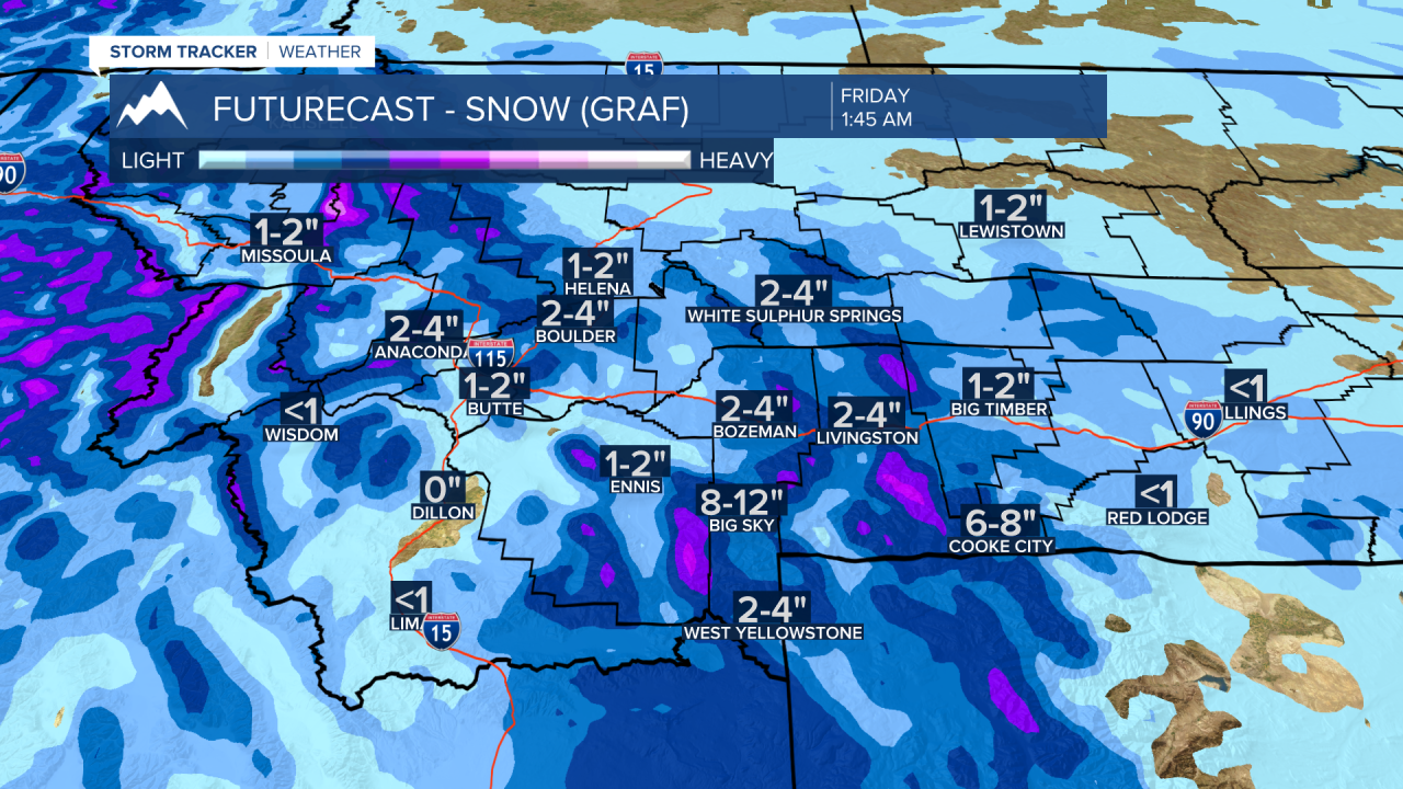
Storm #2 is a Pacific storm with warmer air and more snow. A Pacific cold front will pass through the state from west to east Thursday into Friday producing more snow and difficult travel conditions especially over mountain passes.
Temperatures are running between 25 to 50 degrees colder at noon on Tuesday compared to the same time on Monday for areas east of the divide. That is Arctic air pushing back into the state but it should also quickly exit the region by Friday.
The National Weather Service has a WIND CHILL ADVISORY up for the NE corner of Montana through Wednesday afternoon with feels like temperatures as cold as minus –30 degrees below zero or colder.

The National Weather Service continues a WINTER WEATHER ADVISORY from NW Montana through the SE corner of the state. The advisory continues east of the divide for SW Montana through 3 pm Wednesday. The advisory for the Butte-Blackfoot region is up through 11 pm Tuesday.

The areas highlighted will see snow, blowing snow, bitter wind chills and difficult travel conditions Tuesday evening through Wednesday morning.
Snowfall forecast models continue to show around 1”-4” is possible from Helena to Bozeman to Billings but west of the divide less than an inch through Wednesday evening.
Storm #2 will bring a better chance of snow across all of SW Montana Thursday into Friday. By early Friday morning most valleys could see several new inches of snow and all mountain passes will see moderate snow accumulations. Higher mountain peaks could see a foot or more of snow by Friday afternoon.
By the weekend the weather will return to dry with near normal temperatures.
