


BOZEMAN - 2 rounds of snow will impact travel conditions across SW Montana. The first will arrive Sunday into Monday morning and second arrives Monday night into Tuesday morning.
Valley and mountain snow is likely with both disturbances. The first round will also have gusty surface winds and that combination will produce difficult travel conditions with snow and blowing snow reducing visibility Sunday into Monday morning. A cold front will produce the stronger wind gusts Saturday night through Sunday and behind the front look for colder temperatures by Sunday.
The second round will also bring scattered valley and mountain snow to SW Montana Monday night into Tuesday morning and once again look for difficult travel conditions with snow-covered and icy roads and short bursts of snow reducing visibility.
The National Weather Service continues a HIGH WIND WARNING for the northern front range with peak gusts 60 to 85 mph through Sunday night.
The National Weather Service issued a WINTER WEATHER ADVISORY across most of central Montana Saturday night through Sunday night. Mountain snow accumulations of 4"-8" is possible along with wind gusts 40 to 50 mph producing areas of blowing snow and very low visibility.

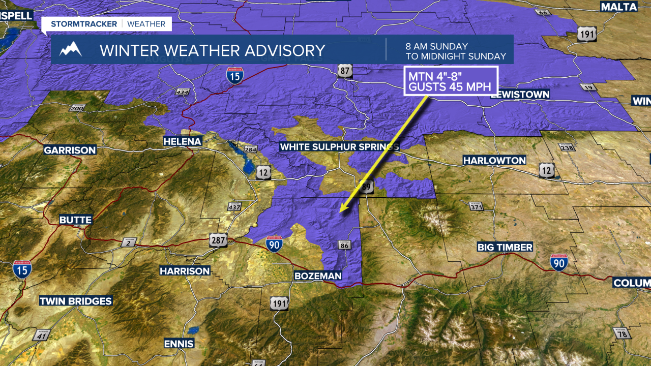
The National Weather Service issued a WINTER WEATHER ADVISORY for Northern Gallatin county Sunday morning at 8 am through midnight Sunday. This includes the Bridger Range and Bozeman Pass. Mountain snow accumulations around 4"-8" is possible and peak wind gusts 40 to 50 mph are possible producing blowing snow and lower visibility travel hazards.
Valley snow accumulations Sunday through Tuesday will be highly varied but in general 1"-3" is a mid range for possible accumulations. That might not sound overly impressive but that is enough snow to produce snow-covered and icy road conditions impacting Monday and Tuesday commutes.

