


BOZEMAN – Numerous record lows broken Thursday morning around SW Montana. A full list of the new record lows will be included in tonight’s forecast at 5:30 pm and 10 pm on KXLF and KBZK.
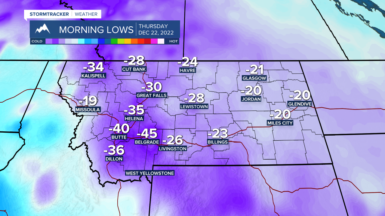
Elk Park MDT sensor recorded a minimum temperature of –50 below zero this morning with a wind chill of –74 below zero. This was one of the coldest temperatures recorded in the state Thursday.
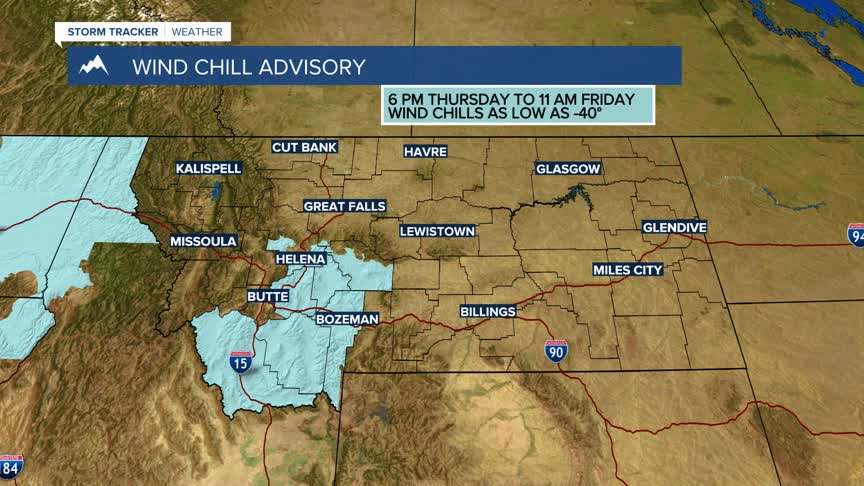
Wind chill values Thursday morning around SW Montana were noted between –50 to –74 below zero. The good news is that the Wind Chill Warning will expire Thursday evening at 6 pm. The bad news is that a Wind Chill Advisory will begin at 6 pm and to through 11 am Friday.
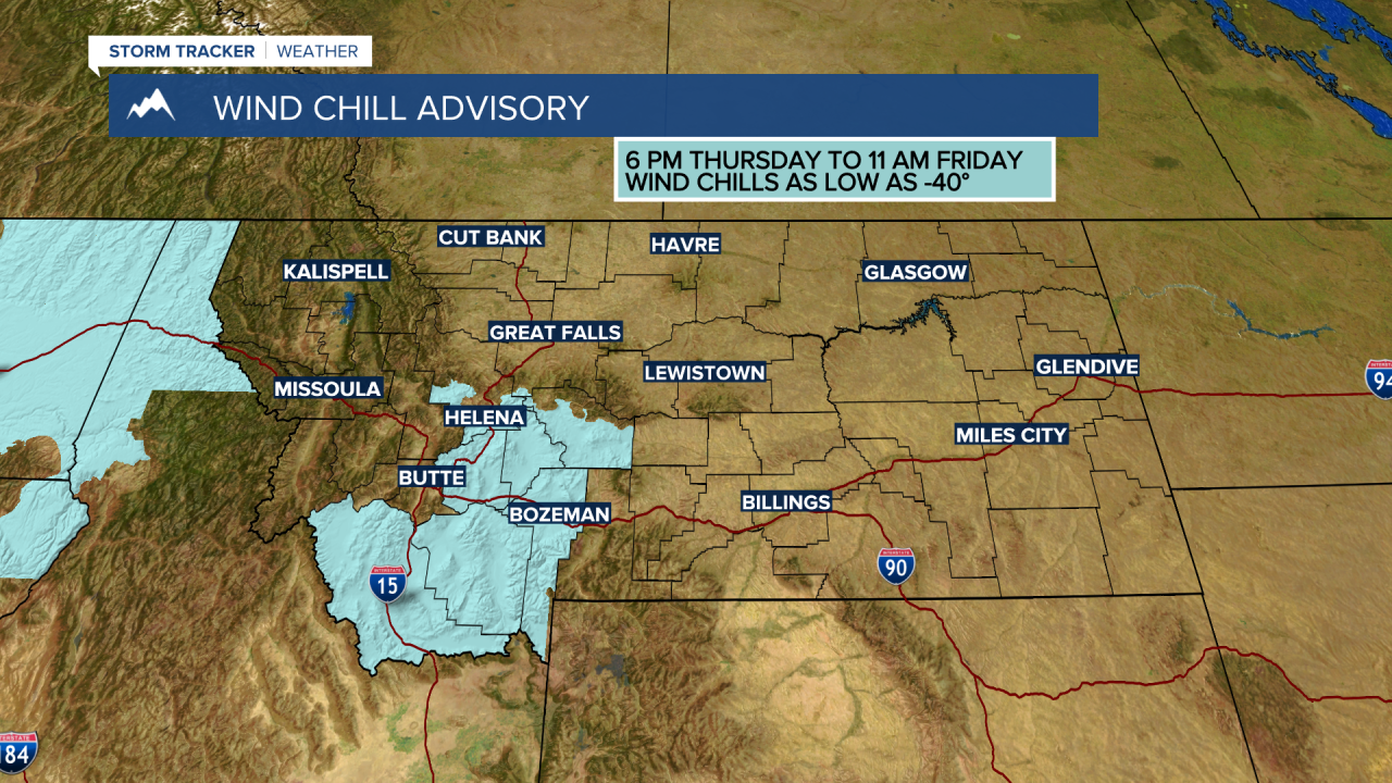
Wind chill temperatures could fall as low as –40 below zero Thursday night into Friday morning.
One more night of extremely cold temperatures across the state with forecast lows locally in SW Montana back down between –20 to –30 below or colder.

Starting Friday afternoon a weak disturbance will push in from the west and produce areas of light snow through Saturday morning. This will help kick off a slow warming trend into Saturday with a substantial rise in temperatures overall by Christmas Day and into early next week.
In fact, we could see highs in the lower 40s next week and that is considered above normal.
The 6 to 10 day forecast is favoring above normal temperatures beginning Sunday through the end of the month and above normal precipitation.
That might sound wonderful, but the forecast does have some rain/snow mix occurring next week and depending on the timing of the moisture there could be some localized areas of freezing rain which will have a big impact on travel conditions.


