


POLSON — The Boulder 2700 fire eight miles east of Polson has burned 1,134 acres and is 0% contained.
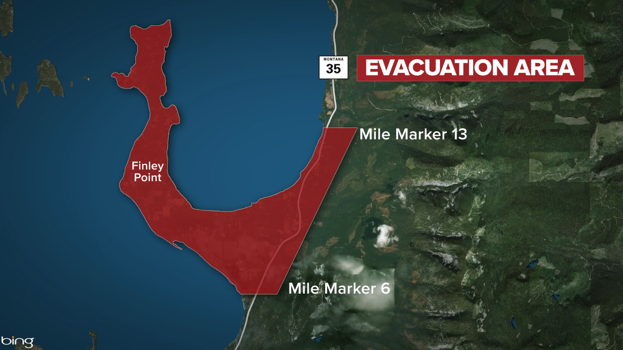
The Lake County Sheriff’s Office has issued evacuation orders for residents along Montana Highway 35 from mile marker 6 to mile marker 13 on the east side of Flathead Lake, including all of Finley Point.
- RELATED: Devastation of Boulder 2700 fire seen from Flathead Lake
- RELATED: Cooperation praised at Boulder 2700 fire
Additionally, to ensure public and firefighter safety, Highway 35 is closed in both directions from Polson at the US Highway 93/MT Highway 35 junction to Blue Bay at mile marker 15.

There will be a community meeting Monday at 6:30 p.m. at the Polson High School Gym in Polson. The Red Cross is operating a shelter for evacuees at the Lindermann Elementary School in Polson.
Northern Rockies Incident Management Team 4 took command of the Boulder 2700 Fire at 6 a.m. Monday.
Fire crews are supporting the Lake County Office of Emergency Management as they work through structure damage assessments for the next several days. Firefighters are also providing structure protection within the fire area.
The latest update notes firefighters will focus on providing structure protection as well as establishing the start of containment lines on both the north and south flanks of the fire perimeter.
The Boulder 2700 Fire is burning timber in the Mission Mountains east of Flathead Lake in steep roadless terrain on July 27. Overnight on July 31, extreme wind shifts and high temperatures allowed the fire to spread past the control lines and through community areas.
Residents can sign up for Lake County Emergency alerts here.
-
Be Prepared: Evacuation Tips
Helpful tips and suggestions should you need to evacuate due to a wildfire -
Wildland Fire Terminology 101
Search common terms used in wildland firefighting and reporting to better understand what is happening during a fire. -
Fire Restrictions in Montana
View a map showing current fire restrictions in across Montana. -
Wildfire Watch: Submit Your Photos
Click here to share your photos or videos with MTN News.
