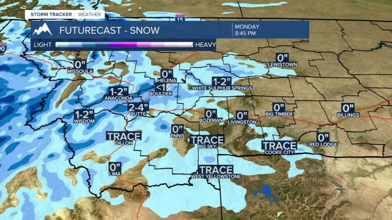
Today's Forecast: Winter storm warnings and winter weather advisories are out for Monday evening and Tuesday as a cold front lumbers into the region. Afternoon temperatures will be warm with highs in the upper 30s to low 40s as clouds build late in the day. Isolated snow showers will pick up west of the divide for the late afternoon and will push through SW Montana through the evening. Bands of heavy snow are expected after sunset and will keep roads snow-packed and icy for Tuesday morning.
BOZEMAN: High: 41; Low: 18. Partly cloudy skies will turn overcast by the evening. While temperatures will be warm to start out during the afternoon. Light snow will develop during the evening with heavy snow overnight. Accumulations in the area are expected to be 4”-8” depending on elevation by Tuesday morning.
BUTTE: High: 38; Low: 12. Mild temperatures for Monday early afternoon. A cold front will move in during the late afternoon and is likely to leave between 2”-4” by Tuesday morning.
DILLON: High: 37; Low: 7. Late-day snow showers could impact the evening commute and will certainly leave slick roads in place for Tuesday. The latest models are showing between 1”-2” for Dillon and the surrounding area.
WEST YELLOWSTONE: High: 32; Low: 7 Clouds will build into the area for the afternoon with pockets of snow for the late afternoon and heavier snow for the evening. Snowfall totals are expected to be between 1”-3” by Tuesday morning.
WINTER STORM WARNINGS AND WINTER WEATHER ADVISORIES
Winter Storm Warnings have been issued in Gallatin, Madison, and portions of Beaverhead counties as well as the southern tier of Montana through 11 PM Tuesday. While most valleys are expected to pick up significant snow, many of the concerns for heavy snow will fall on area passes and high mountains. Right now 4”-8” is possible for the valleys with 6”-10” for area passes.

A Winter Weather Advisory has been issued for the remaining area from 5 PM Monday through 2 PM Tuesday with 2”-5” in valleys and 4”-8” for mountains and passes.
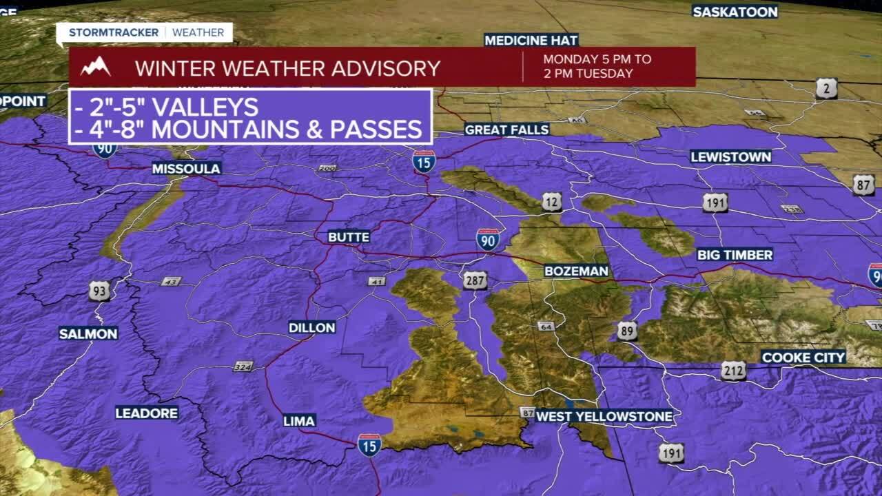
Much of the concern for the time period will revolve around warm temperatures for Monday followed by bands of snow that may initially melt on area roads before freezing. That will create icy roads followed by bands of heavy snow. Significant travel concerns are expected for the area by Tuesday morning and likely stay slick for Tuesday night.