


Today's Forecast: A fine and consistent snow is falling across southwest Montana this morning and creating slick driving conditions and poor visibility. Several slide-offs have been reported across the region. Dangerous driving conditions should be expected through the afternoon. Expect snow to continue through the early afternoon before snow begins to slow for the afternoon. Highs will stay in the single digits and low double digits through the afternoon and evening.

BOZEMAN: High: 8; Low: -4. Poor visibility is expected for the morning as a fine light snow falls across the area. Temperatures are expected to fall through the afternoon with a light north wind between 5-10 mph.
BUTTE: High: 17; Low: 2. Slick roads are in place for the morning drive with light snow continuing through the early afternoon.
DILLON: High: 17; Low: 8 Cold and snowy for the morning. Temperatures will remain cold with temperatures falling through the afternoon.
WEST YELLOWSTONE: High: 24; Low: 7. Snow and chilly for the morning with light snow through the afternoon and evening. An additional 2”-3” likely through the afternoon.
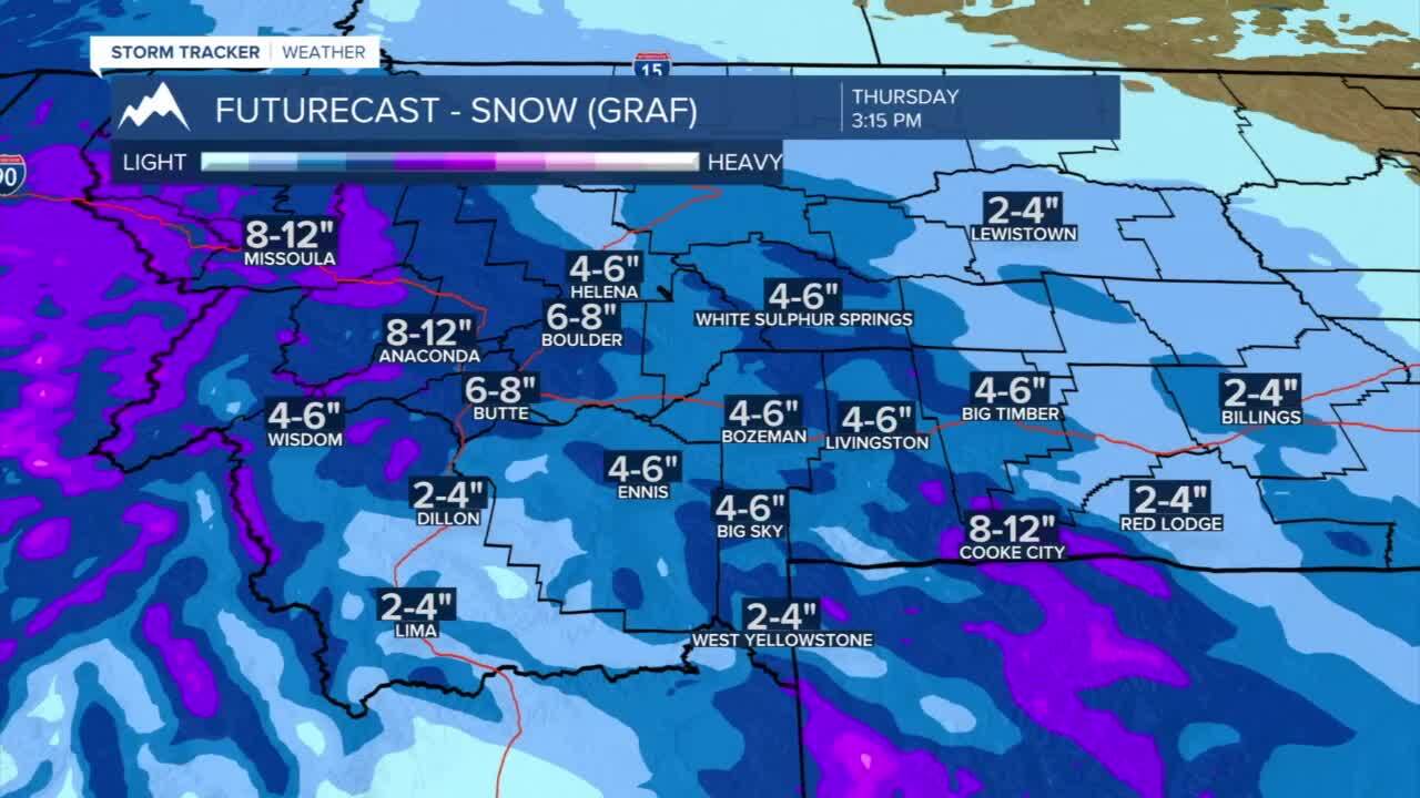
Third round of snow develops Thursday morning: Another round of snow will develop overnight tonight. A warm and moisture rich system, you should expect snow on Thursday and Friday to be a heavy and wetter snow that will likely impact commutes starting on Thursday morning through early Friday morning. The latest on Thursday and Friday’s storm could bring an additional 3”-6” of snow to valleys with 10” or more possible in the mountains of southwest Montana.
