


Today's Forecast:
We are once again dealing with the potential for scattered rain showers in southwest Montana for your Wednesday. Highs will be cooler and stay in the low and middle 50s in the region with off and on showers expected through about 8 PM. Skies will slowly clear tonight and allow lows to fall back to the 30s overnight.
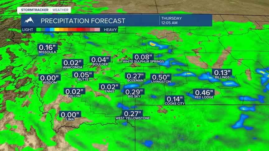
BOZEMAN: High: 53; Low: 36. Expect pockets of light to moderate rain through the afternoon and early evening with a northwest wind between 10-20 mph.
BUTTE: High: 53; Low: 32. Area light showers are possible today with skies clearing tonight. Lows will quickly fall back to the low 30s with patchy frost possible.
DILLON: High: 53; Low: 33. Spotty rain showers are likely through the early afternoon before the clouds clear and allow lows to fall swiftly to the low 30s.
WEST YELLOWSTONE: High: 49; Low: 26. Spotty showers and occasional thunderstorms are possible during the early afternoon with a couple of light snow showers early in the evening.

SNOWPACK NUMBERS ARE UP: The snow we picked up this weekend helped our snowpack numbers across Montana. The best numbers in the state range slightly above average through central and north central Montana. Southwest Montana is still struggling in the Madison range with 68% of normal moisture. We have a slight improvement in the Jefferson range. The Gallatin range is 95% of average for this point in the year. The forecast does show a dry stretch through the weekend and early next week with above average temperatures through the middle part of next week.
