


Today's Forecast:
Crisp and cold to start the day with mostly cloudy skies for the afternoon. Look for highs in the middle 30s with light northwest wind between 5-15 mph for most of the area. Light snow develops toward the evening with light accumulation of nearly an inch by early Tuesday morning.
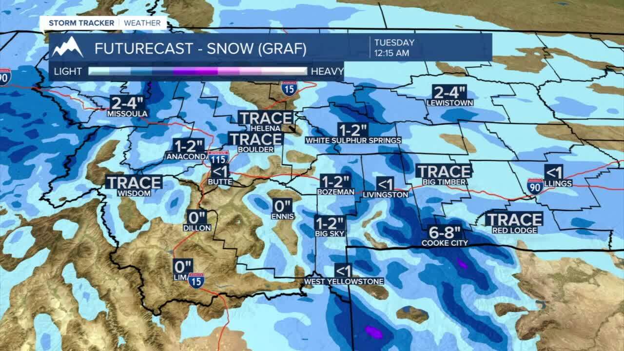
BOZEMAN: High: 35; Low: 23. Mostly cloudy skies and a light northwest wind between 5-15 mph. Late afternoon snow showers are likely to develop around 5 PM and will linger through the early morning hours of Tuesday. Accumulations are likely to be between 1”-2”.
BUTTE: High: 38; Low: 22. Mostly cloudy and chilly for the morning with late day light now showers bringing less than 1” to the area overnight.
DILLON: High: 40; Low: 26 Cloudy and chilly through the afternoon. A few flurries are possible, but no significant accumulation expected.
WEST YELLOWSTONE: High: 27; Low: 20. Pockets of light snow develop through the afternoon and evening. Accumulations near 1” by Tuesday morning.
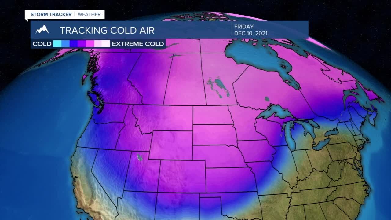
Another cold swing late this week:
Another cold front is expected to move in Wednesday and keep our temperatures chilly late this week. The transition will likely bring rain late on Wednesday that will transition to snow overnight. While accumulations are not likely to be substantial, we will probably see winter driving issues early Thursday morning.
