
BOZEMAN – A weak disturbance is producing intense short duration snowfall across SW Montana Monday afternoon. This disturbance should pass out of our region and head east overnight. Some local mountain passes have picked up around 5″ of snow and valleys have seen 1″ – 3″. Just enough snow to produce snow covered, wet and icy roads tonight.
NEXT WEATHER MAKER
The next storm event will clip SW Montana Tuesday afternoon through Wednesday. A stronger pacific storm will dig under Montana passing through Salt Lake City, UT over to Denver, CO and up to Minneapolis, MN Tuesday through Thursday.
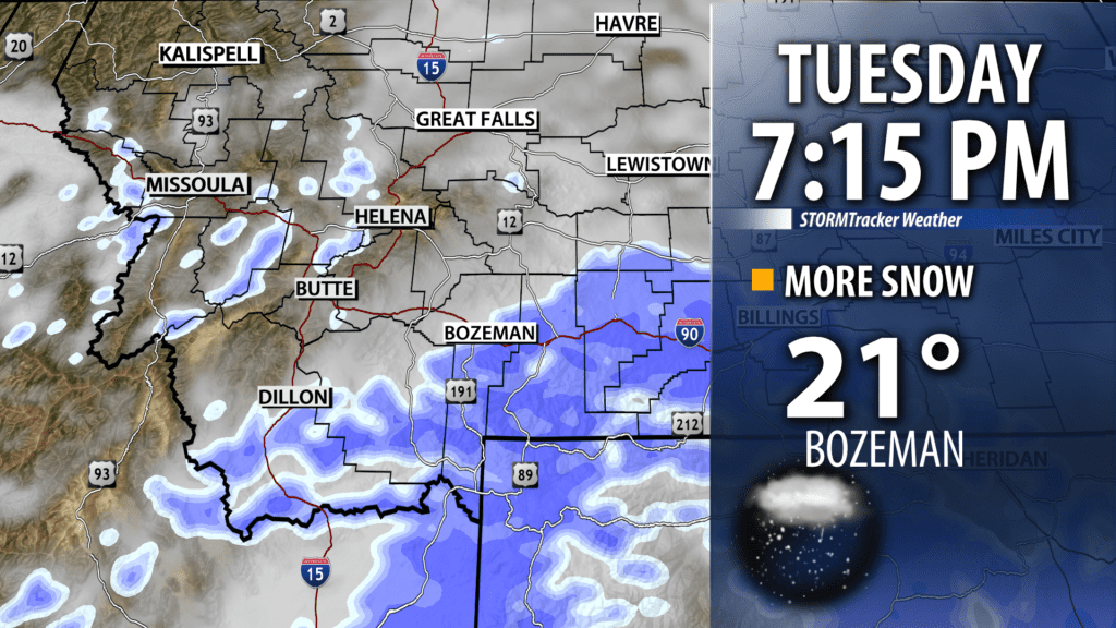
Much of southern Montana will see periods of moderate to heavy snow Tuesday evening. Locally, draw a line from Dillon to Lewistown, east of that line could see periods of moderate snowfall Tuesday night. Greatest travel concerns Tuesday afternoon into Wednesday will be from Bozeman to Billings on I-90. Bozeman could see 2″ – 4″ of snow Tuesday evening and Billings could see 4″ – 6″ of snow Tuesday evening.

City by City Forecast:
BOZEMAN: LOW: 15°; HIGH TUESDAY: 29°. Snow will taper by early evening with partial clearing overnight. Watch for wet roads to turn icy this evening and watch for patchy valley fog Tuesday morning. Next round of snow will arrive Tuesday afternoon through Wednesday morning. Snow accumulations of 2″ – 4″ are possible for Bozeman Tuesday evening.
BUTTE: LOW: 7°; HIGH TUESDAY: 26°. Clearing skies likely overnight and temperatures will be colder. Patchy valley fog is possible Tuesday morning. Clouds will roll back in with a slight chance for additional snow Tuesday afternoon into Wednesday morning with 1″ – 2″ possible.
DILLON: LOW: 11°; HIGH TUESDAY: 28°. Scattered snow is possible Monday afternoon but should diminish by midnight. Partly cloudy and colder Tuesday morning. Increasing clouds and snow is likely Tuesday afternoon into Wednesday morning with 1″ – 3″ possible.
WEST YELLOWSTONE: LOW: 3°; HIGH TUESDAY: 24°. Scattered snow through the early evening hours is likely with 1″ – 4″ possible. Partly cloudy and colder overnight. Next storm will bring increasing snow Tuesday afternoon through Wednesday morning with 2″ – 4″ or more possible.
