


MISSOULA – The Hungry Horse and SKQ dams are low this year, which is impacting the low water levels on Flathead Lake.
We talked with the National Weather Service office in Missoula to learn what has led to this summer's situation in the Mission Valley.
“We had really a double edge sword coming at us with low snowfall, especially the latter half of the winter. And a record dry May and June in that same basin,” noted NWS Meteorologist Corby Dickerson.
While it wasn’t the coldest or wettest winter, it may have been the longest. The first snow fell at the beginning of November and didn’t leave until mid-March. So it may come as a surprise that for many locations — especially in Northwest Montana — snowfall was well below normal.
- RELATED: Dr. Steve Running explains Flathead Lake level connection to climate change
- RELATED: Cabin owners forced to adjust to record low Flathead Lake levels
- RELATED: Woods Bay marinas, businesses discuss low Flathead Lake water levels
- RELATED: Low Flathead Lake levels could impact farmers' bottom lines
- RELATED: Dam operators: Beginning of pattern of ever-decreasing levels in Flathead River Basin
- RELATED: Montana Congressional delegation response to record low Flathead Lake levels
"About the end of December it just stopped, at least across Northwest Montana,” Dickerson explained. “We continued to get some snow in March -- especially in the west-central part of the state and southwest part of the state. But Northwest Montana stayed in the doldrums.”
While that was one factor, another was that after a wet May, June quickly dried out — again in Northwest Montana — leading to some record dry conditions in that part of the state.
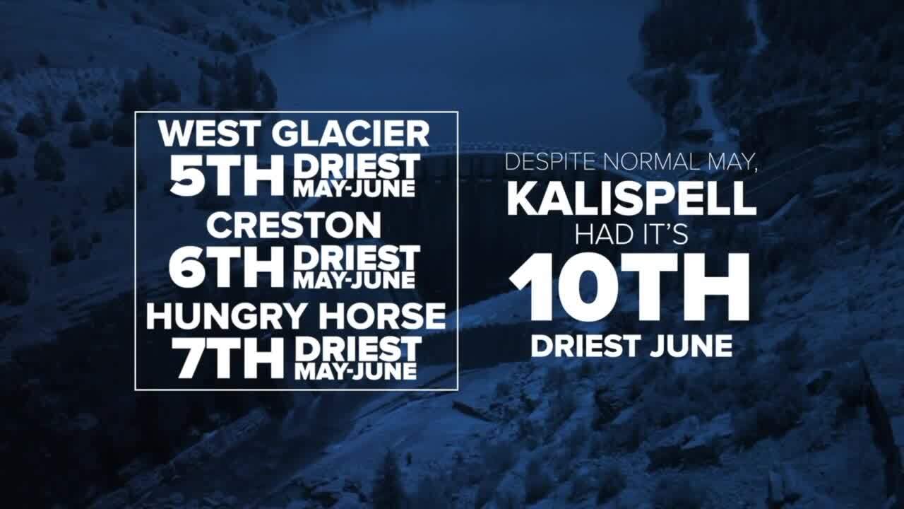
“So West Glacier had its fifth driest May through June period. Creston had its sixth driest May through June on record. Hungry Horse had its seventh driest May through June on record. Kalispell, despite a normal May, had its tenth driest June on record," Dickerson explained.
The National Weather Service has sensors in the mountains around the region, and Dickerson showed us one in Glacier National Park — a basin that feeds into the Flathead River and then Flathead Lake.
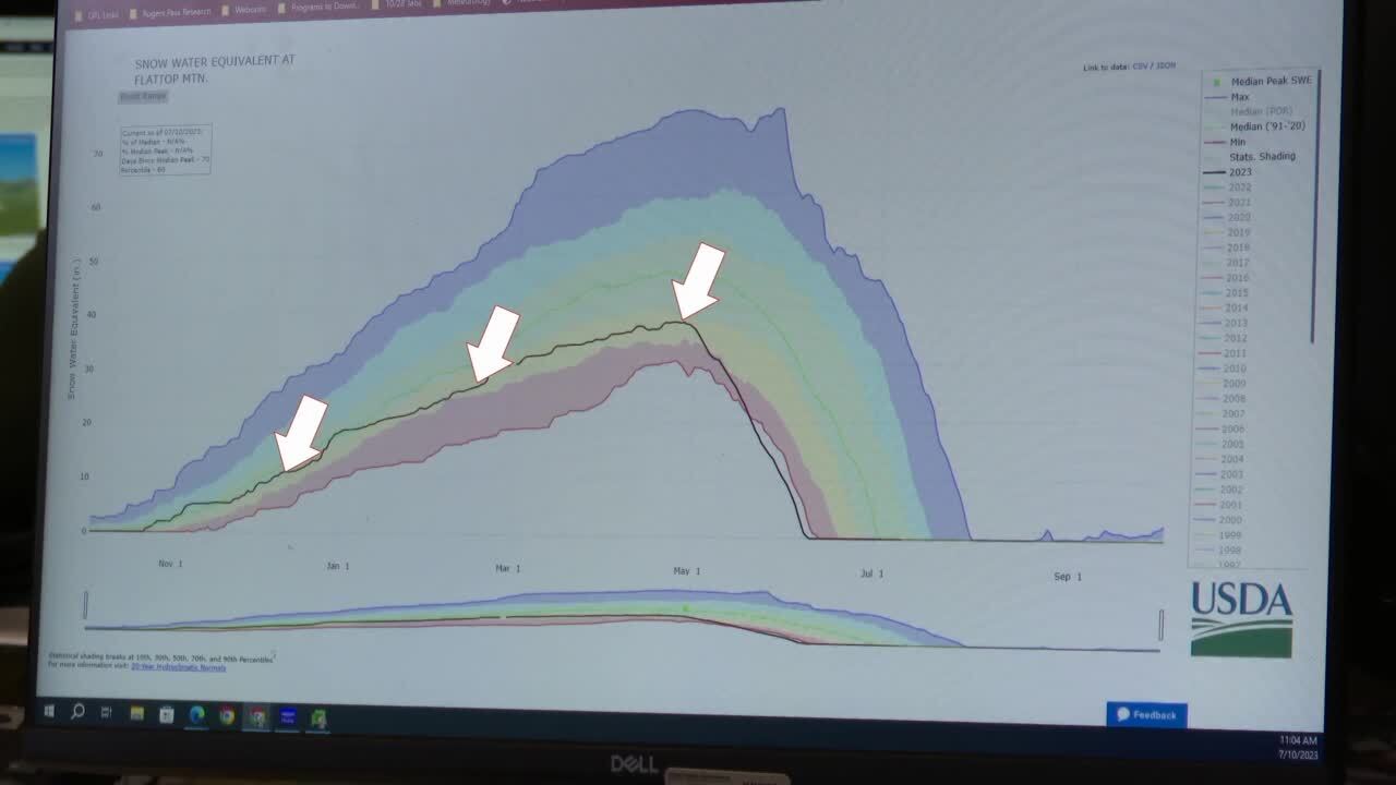
“Basically this is Flattop Mountain, and you can see they are in the yellow, and pretty much stayed in the yellow for most of the year. So, we’re on the lower third for normal,” Dickerson demonstrated. “And this shows that this year was actually the earliest full melt out of this high elevation snow tell site. So, we were three weeks ahead of schedule.”
When you put all these factors together, it becomes clear why Flathead Lake is so low this year.
Watch the full KPAX special report below.
