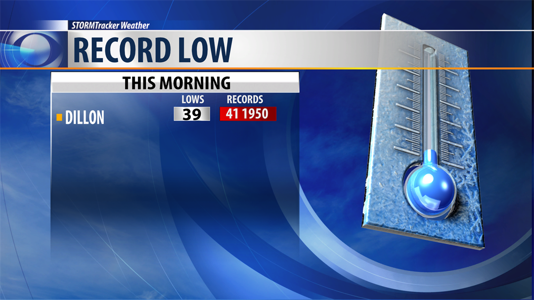
This week’s weather pattern will go from one extreme to the other. Chilly this morning across SW Montana with lows dropping down into the upper 20s to lower 40s and at least 1 record low in Dillon.
The upper level trough over Montana brought cooler temperatures to the state Sunday and today and slightly better air quality with less wildfire smoke.
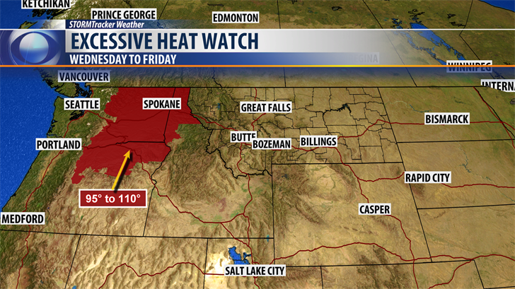
Looking ahead to the rest of this week the pattern will swing back to a blocking High pressure ridge and a buildup of heat and yes increasing wildfire smoke is likely to impact air quality again beginning Wednesday through the upcoming weekend.
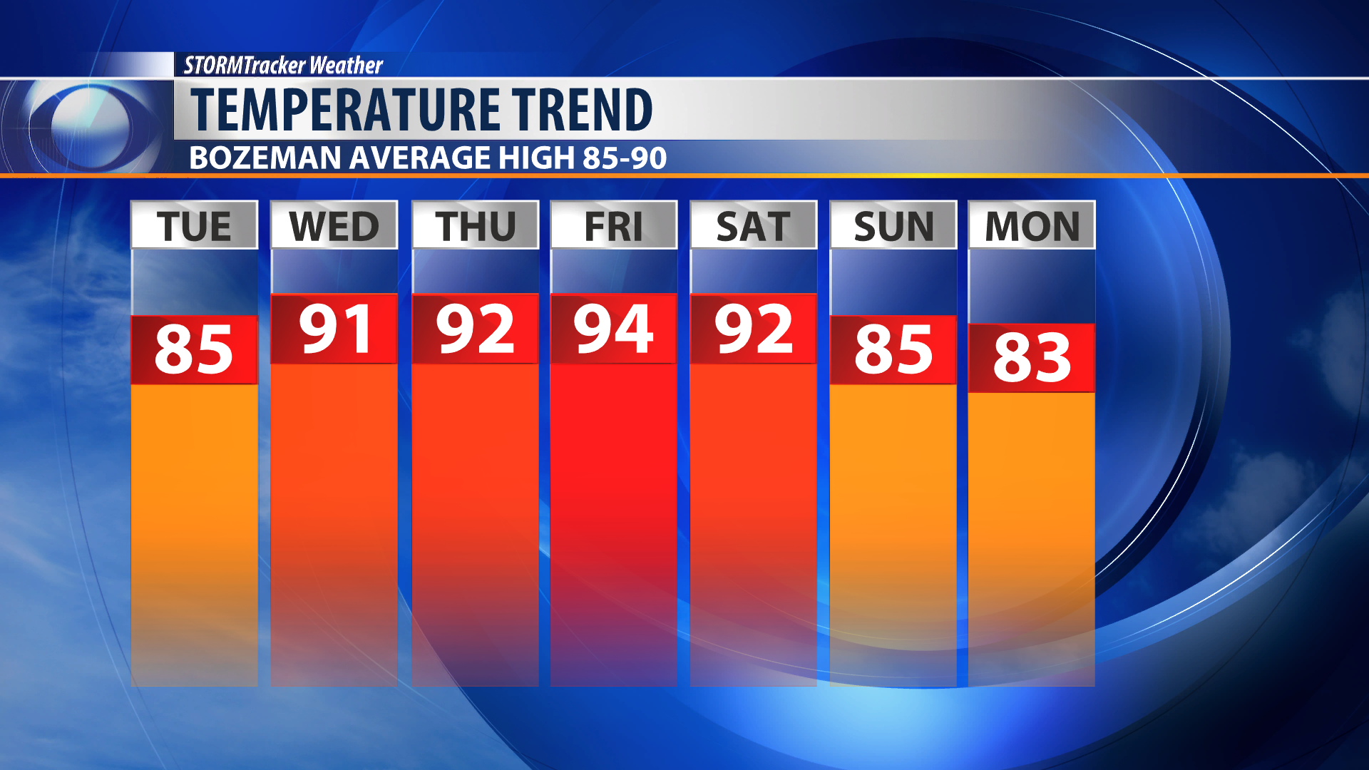
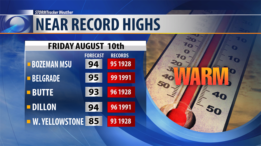
Temperatures will jump to near record high levels especially by Friday.
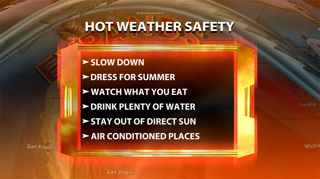
A good reminder to slow down as the weather pattern changes to excessive heat.
There is an "Excessive Heat Watch" up for parts of Washington and Oregon Wednesday through Friday.
Here is Bozeman/Belgrade 7 day forecast highs. Temperatures will jump up sharply beginning Wednesday.